A warning in advance: This post is going to be almost entirely gratuitous earth-porn. If you don't like looking at pictures of mountains, you should probably click away.
I kept heading north on 93 the next day after camping in that field watching the sunset; sometime mid-day I made it to the town of Golden, and stopped in at the local tourist info booth to see what my options for food were.
While I was browsing the brochures, I noticed . . . something interesting. Apparently, there's a world-famous hang-gliding launch point here, just off the tip of one of the mountains, and a forest service road going up to it.
Sounds like a plan to me!


Up up up!

And as usual, endless little ATV/moto-cross trails heading off into the forest. I was nowhere near silly enough to actually try taking my bike on them . . . but I wanted to.

It was about ten miles up the road as it wound around the mountain, and the view at the top was breathtaking.

Indeed, this was a popular place to launch from. Many people had their hang-gliders set up and ready, and there was even a nice deck/launch platform built on the crest of the hill.


What a fantastically beautiful location.

But hang-gliding wasn't the only thing done from here. There was a company (by which I mean, "Two guys and a van") doing tandem para-gliding flights out from here. It wasn't cheap, the better part of $200, but . . . c'mon, how can I resist that?

Weeeeeeeeeee!

That white canopy out in the distance there was the guy who went off just a few minutes before me. Launching is a very strange and disconcerting experience; they lay out the canopy behind you, strap you to the instructor, and then tell you to run full-speed at the edge of a cliff. JUST as you swear you need to slow down so you don't fall off the edge and die, you feel a massive tug through the harness like the hand of god has pulled you backwards, and a moment later your feet leave the ground.
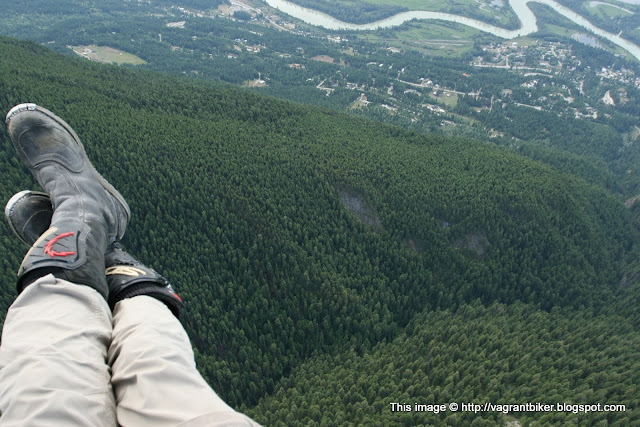
It's WAY more comfortable than skydiving was; when para-sailing, you're sitting in what amounts to a big chair-shaped canvas bucket, as opposed to the straps that cut into your crotch when skydiving. It's very pleasant and a perfect way to take in the scenery.


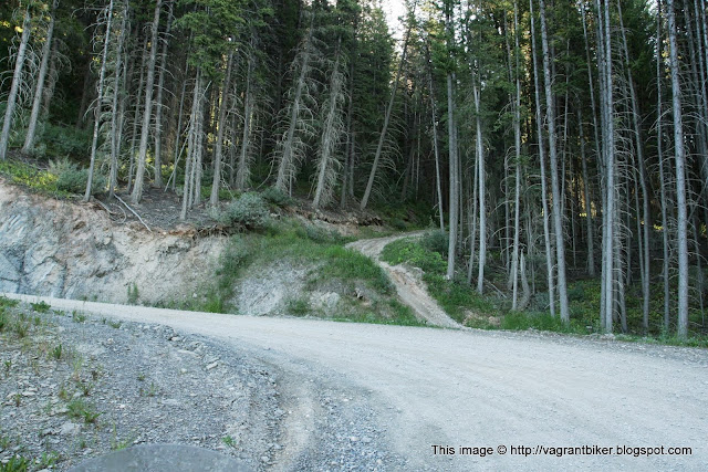
I kept heading north on 93 the next day after camping in that field watching the sunset; sometime mid-day I made it to the town of Golden, and stopped in at the local tourist info booth to see what my options for food were.
While I was browsing the brochures, I noticed . . . something interesting. Apparently, there's a world-famous hang-gliding launch point here, just off the tip of one of the mountains, and a forest service road going up to it.
Sounds like a plan to me!


Up up up!


And as usual, endless little ATV/moto-cross trails heading off into the forest. I was nowhere near silly enough to actually try taking my bike on them . . . but I wanted to.

It was about ten miles up the road as it wound around the mountain, and the view at the top was breathtaking.

 |
| That white line crossing across the mountain base on the right is the highway. |
Indeed, this was a popular place to launch from. Many people had their hang-gliders set up and ready, and there was even a nice deck/launch platform built on the crest of the hill.


What a fantastically beautiful location.

But hang-gliding wasn't the only thing done from here. There was a company (by which I mean, "Two guys and a van") doing tandem para-gliding flights out from here. It wasn't cheap, the better part of $200, but . . . c'mon, how can I resist that?

Weeeeeeeeeee!

That white canopy out in the distance there was the guy who went off just a few minutes before me. Launching is a very strange and disconcerting experience; they lay out the canopy behind you, strap you to the instructor, and then tell you to run full-speed at the edge of a cliff. JUST as you swear you need to slow down so you don't fall off the edge and die, you feel a massive tug through the harness like the hand of god has pulled you backwards, and a moment later your feet leave the ground.
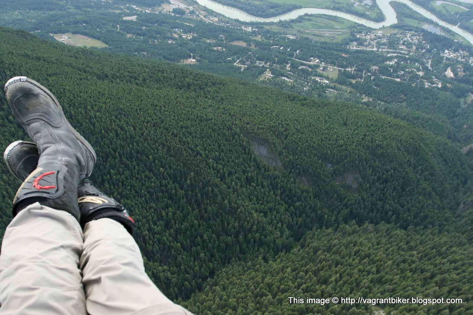
It's WAY more comfortable than skydiving was; when para-sailing, you're sitting in what amounts to a big chair-shaped canvas bucket, as opposed to the straps that cut into your crotch when skydiving. It's very pleasant and a perfect way to take in the scenery.

 |
| I pity people who are afraid of heights, it must prevent them from doing so many fun things. I've never had that problem, but then again, I'm not sure I've developed the fear-of-death part of my brain yet. |


 |
| That's the bike down there, that black dot at the left edge of the parking area by the road |
Yeah, it was a lot of money, but who knows when I was going to be through here again and it was a beautiful ride.
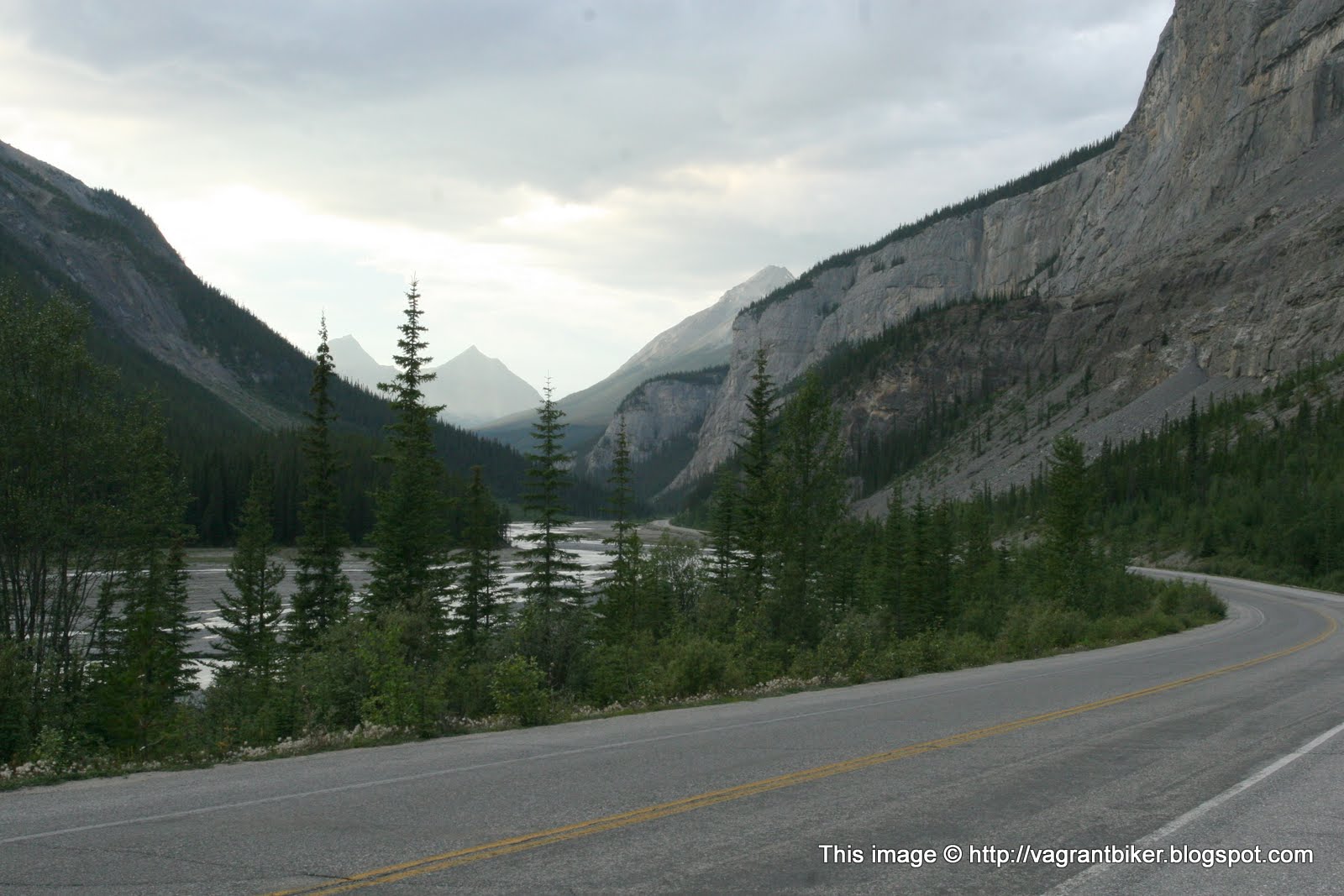
After the ride, I headed east into the various jumble of National Parks that make up this section of the Canadian Rockies. Even the highways in this part of the planet are beautiful and amazing.

At some point I stopped at a little tourist side-section, to checked out something called "The Spiral Tunnels". The geography in this area is way too steep to build standard railroads through, so to get around the steep georgraphy that would have required impossibly steep grades for the locomotives, they cut two spiraling tunnels into the mountains.
 |
| The entrance and exit to one of the tunnels, looping around underground and exiting 30 feet above the entrance |


I chatted with this rider for a few minutes in the parking lot. Why we don't see more sidecars in the USA, I'll never understand.

I headed east to Lake Louis, and then north along the Icefields Parkway in the direction of Jasper.
View Larger Map
There's no words to describe everything that's so great about this place. So I'll let my photos speak for me.


It was getting late in the evening and the sun was starting to set behind the mountains, and I had to find someplace to camp. The campgrounds were all full, and this being a National Park, dispersed camping wasn't allowed . . . which meant I'd have to be sneaky about it

Just after I snapped this photo, I noticed something. See it, way down there in the lower right hand corner, behind the watermark? It was undeniably the remains of a road! Long disused and overgrown, but that was a road down there none the less. The fact that it was obviously abandoned just made it more appealing.
I had to find out what it was, and how to get there. I just had to.
After some poking around, I found what seemed like it would lead down there, probably an old section of the former Icefields Parkway. Long ago replaced with the new modern route that's much less winding and steep, sadly. I'd make sure it got traffic again.
 |
| Good boys go to heaven, and bad boys go to hell, but boys on motorcycles go anywhere we want. |

The path was as I'd hoped it would be. Quiet, overgrown, and serene, but still with enough gravel that it was passable without damaging anything.


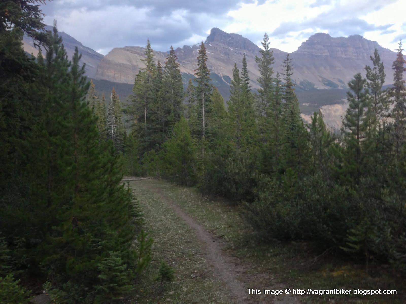
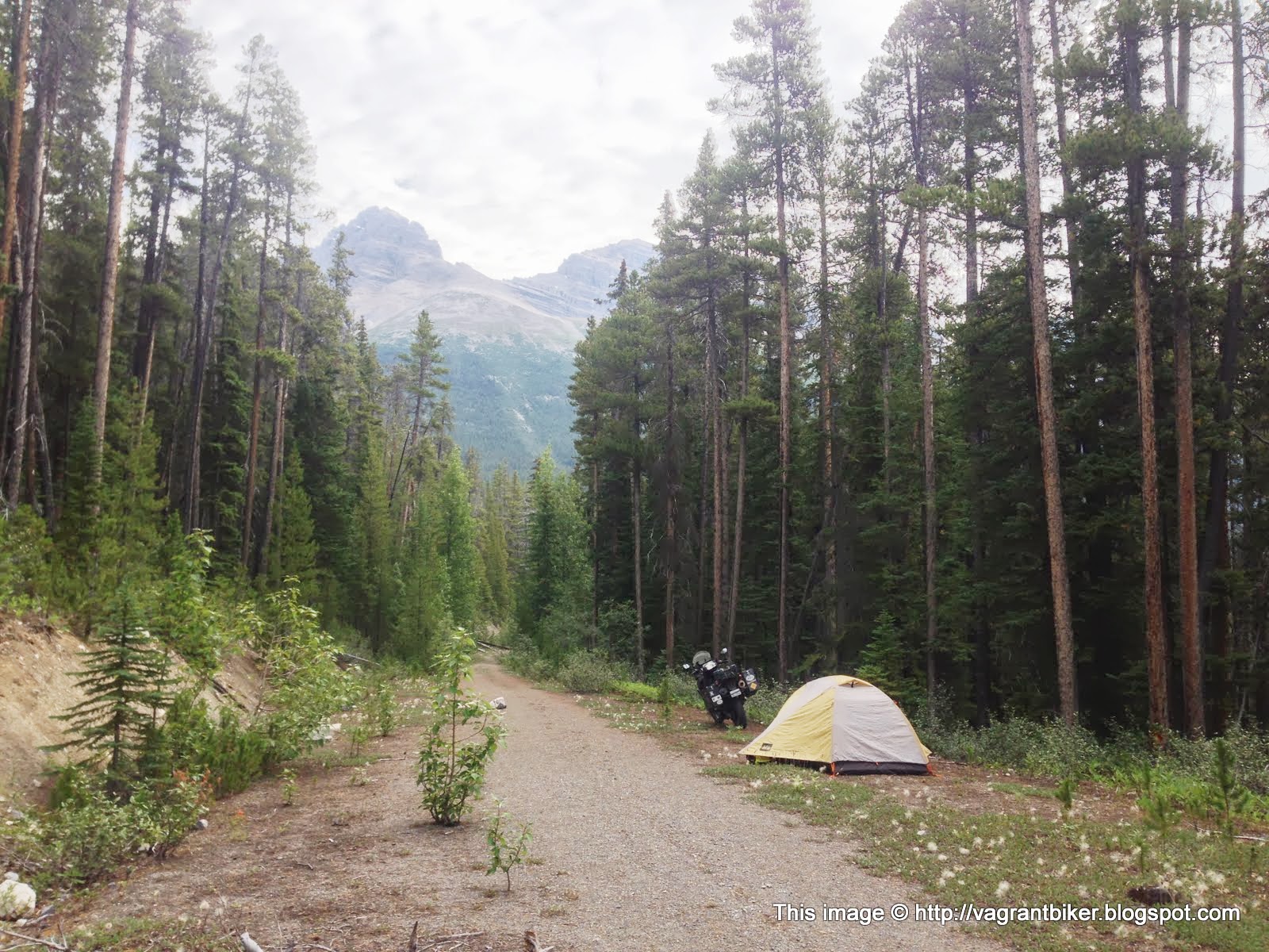
I followed the trail for perhaps a quarter of a mile, well out of site of the road, before stopping and turning around where I took the above photo. I could have easily continued, and really wanted to, but the path was getting rapidly less traveled with much more plant growth reclaiming the former road surface. I didn't want to cause any excessive damage with a heavy bike to the very fragile moss and grasses, so I turned around and found enough of a clearing to set up the tent, next to this strange arrow.


I couldn't figure out what it was; a trail marker indicator, perhaps? It didn't seem to be point to anything that I could notice. A few tracks in the gravel indicated that this route was still used by bicyclists; I made note to get out of here ASAP in the morning, lest someone stumble upon me and object to my presence. I clearly wasn't the only motorcyclist to do this recently; there were other tire tracks from similarly sized and weighted motorcycles visible.
I kept on heading north the next day. What an amazing planet we live on.


 |
| Crazy people! You don't need to use such archaic technologies anymore! We've invented these things called "engines" which make it seem like everywhere is downhill! Even the uphills! |
 |
| GET IN MAH BELLAH. |


