Friday, December 25, 2009

The Lolo Motorway

Heading out of Butte (Haha. Butte), I finally felt I'd made up enough ground on the slab to get off the interstate, and back on more interesting roads. My destination was Portland, where an ex of mine was waiting with my hot-weather riding gear. Northern Idaho looked like it was going to be fun, so this was my planned (quick) route across it. I probably could have/should have spent much longer there, it was really beautiful. Ah well, next trip.


View Larger Map

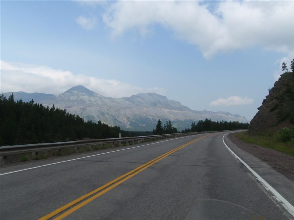
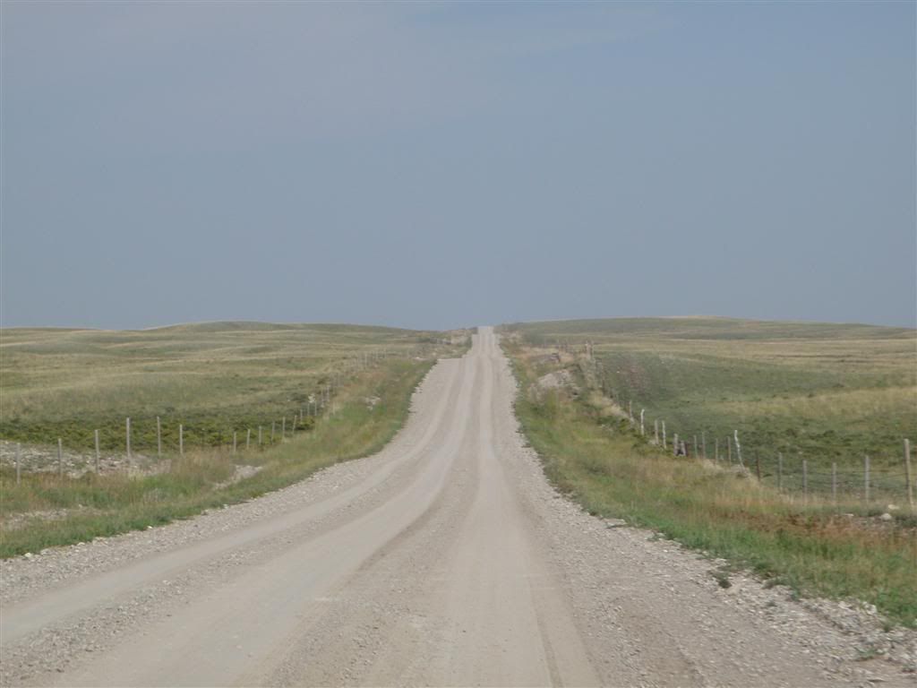
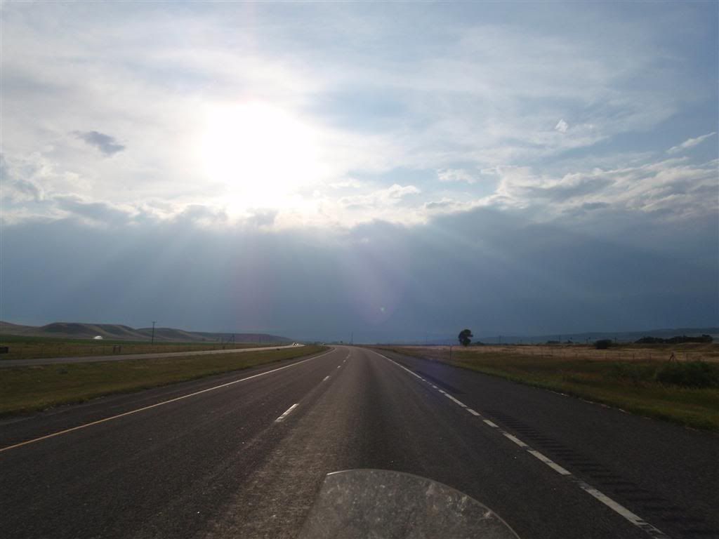
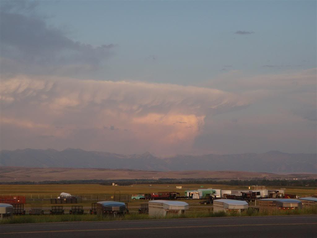
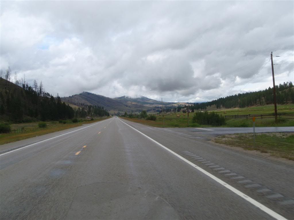
Man, it felt good to get back onto real roads again. Not many other cars, but (always a good sign), quite a number of other bikes. And simply pretty riding.


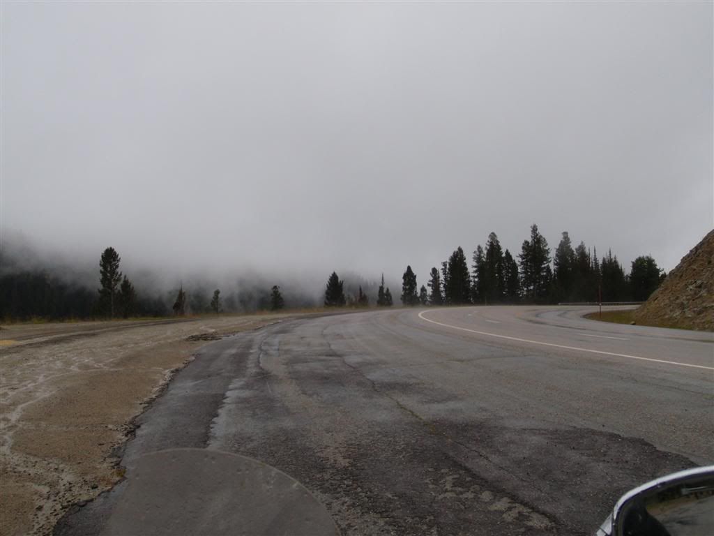
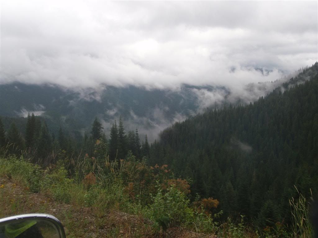
It was cool, and there were patches of rain through the day, which prevented me from riding as stupidly as I wanted to. And at times, some pretty great fog, as the road wound up into the sky.


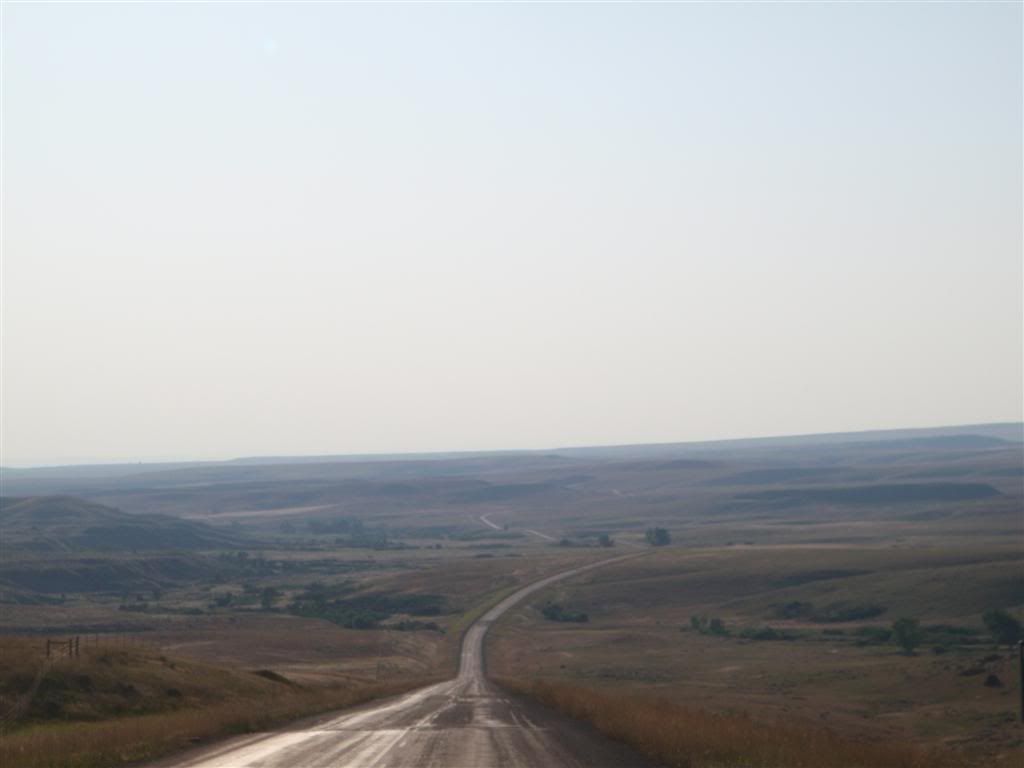
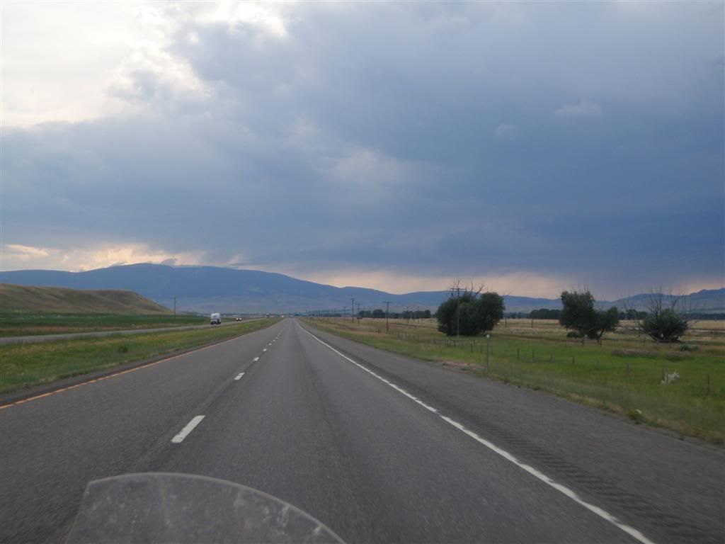
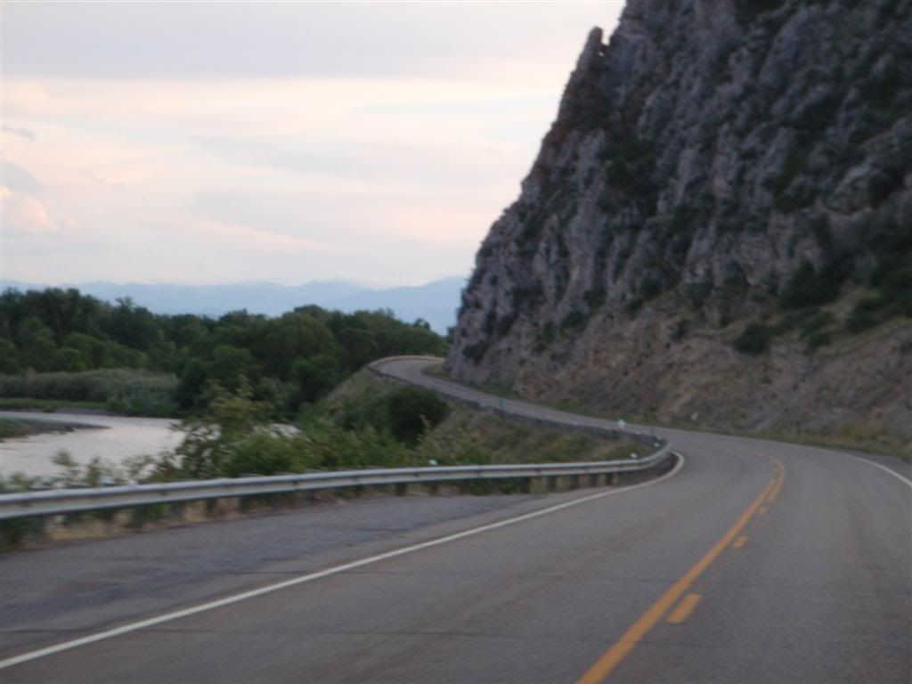
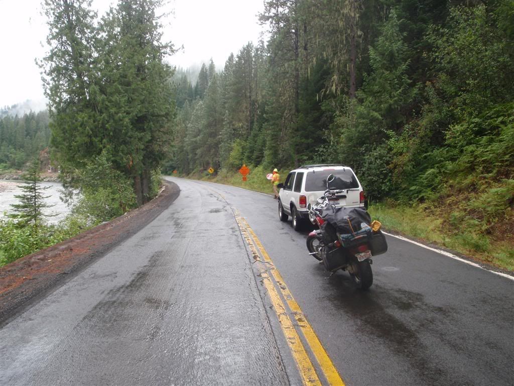
Once I got down over the mountians, I headed north on 93, with the intention of hitting up Rt 12 to go across Idaho. Now, going into this I had no idea what Rt 12 was; it just looked squiggly on the map, and went in the direction I wanted to go. Rt 93 going up there was flat, but at least there were hills that promised good riding soon.


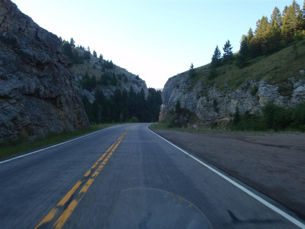
Now, Rt 12 was indeed pretty nice. Curvy, long stretches of up and downhills, and yes some rain, but not terrible.


Oh, what an unfortunate name . . . *giggle*

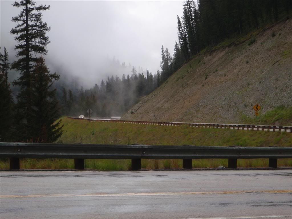
At some point it started to dry out some, so I stopped at a turn-off to take off my rain gloves, and open the vents some.


But as I was packing things back on the bike, I saw something off in the distance.


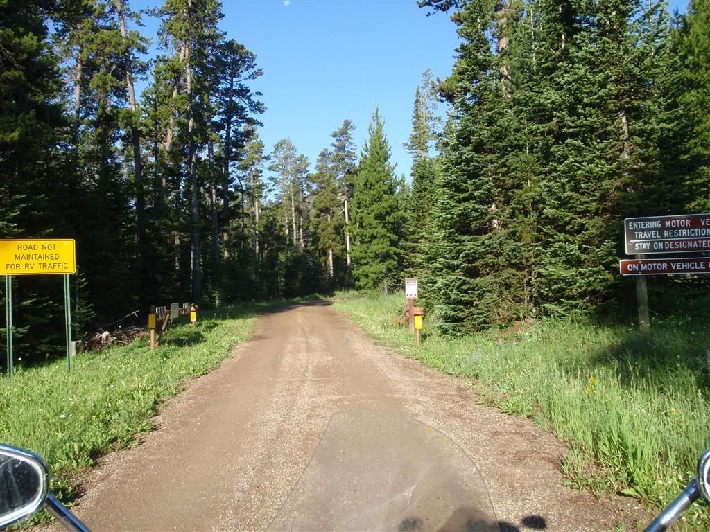
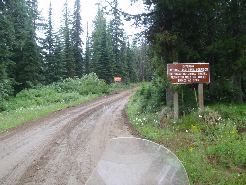
Waaaaaaaait a minute . . . what road was THAT? And more importantly, why was I on asphalt when I could be on it!?


I had to find out how to get to that road. I backtracked about 5 miles on Rt 12 to where there had been a Visitor Center, and I poked my head in there to ask about it.

"Oh, that's the Lolo Motorway", the forest ranger inside said. "It's a very rugged trail, you need a high-clearance vehicle or dirt bike to be able to travel it at all. You'll never make it on a cruiser."

What I said, was "Oh, thanks for the info." What I thought, was "IS THAT A CHALLENGE?!" She was kind enough to give me a little brochure, showing a map of the route, along with how to get to it. Hrm . . . this looked like it would be fun . . .


View Larger Map

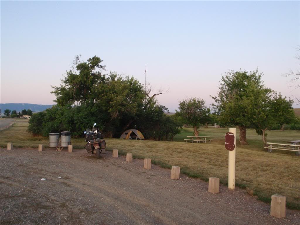
Just to make sure I wasn't ACTUALLY getting myself in over my head, I stopped for gas at a little campground place that seemed to have a lot of other bikers milling about, and went inside to inquire about it. I mentioned the dire warnings the Forest Ranger had given me, and the owner laughed.

"Nah", he chuckled. "You'll be alright, I had my truck up there a couple days ago and they've cleared all the fallen trees on it. Cars won't make it, but on a bike you can pick your way around the boulders and ruts. The Forest Ranger probably just told you that because she thought you were one of them", he finished, gesturing to the line of pirates outside on their Hogs who were, at that very moment, all busily polishing their chrome. "They don't even like our gravel driveway here. But you'll be fine on that road, it's not that bad".

Sweet! I thanked him for his time, and off I went quickly finding the entrance road and heading into the hills.


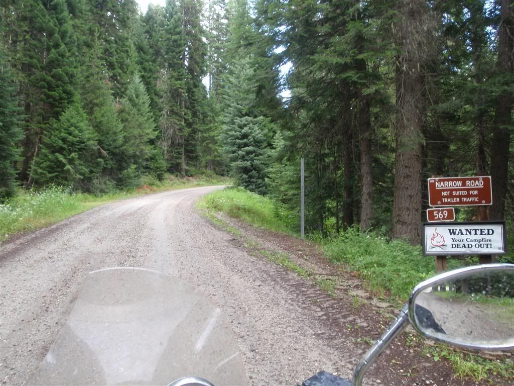
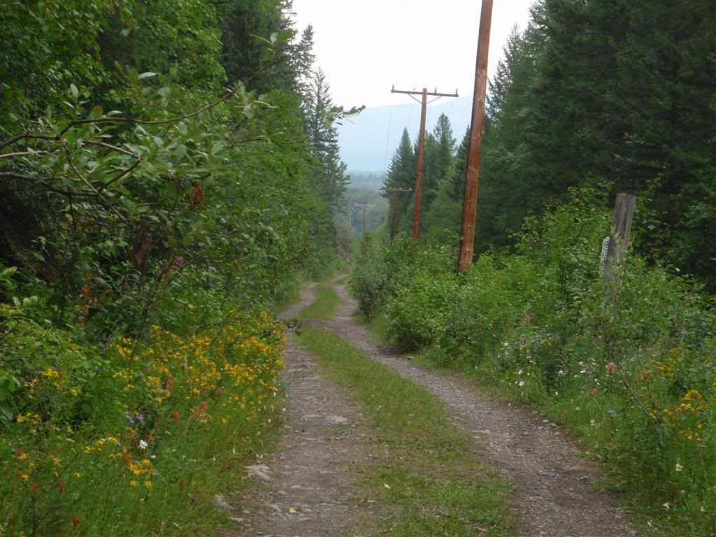
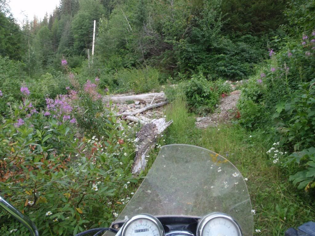
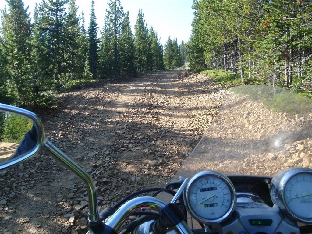
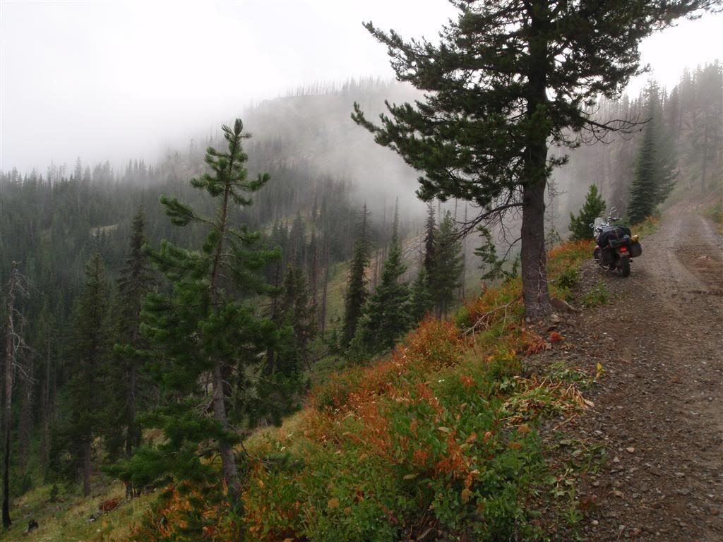
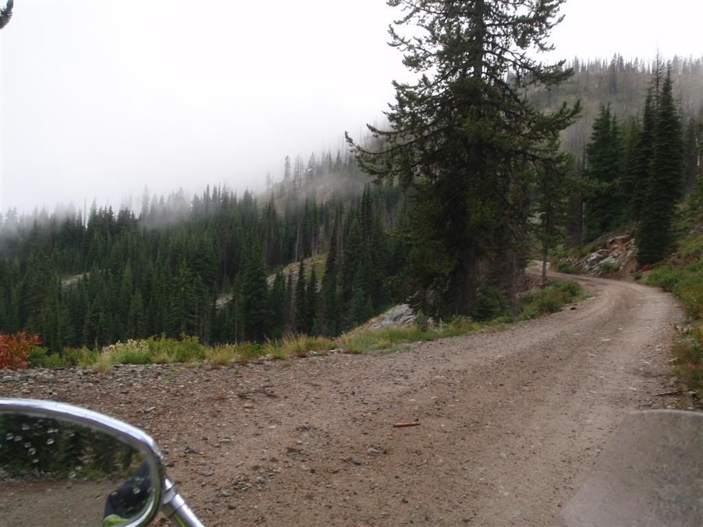
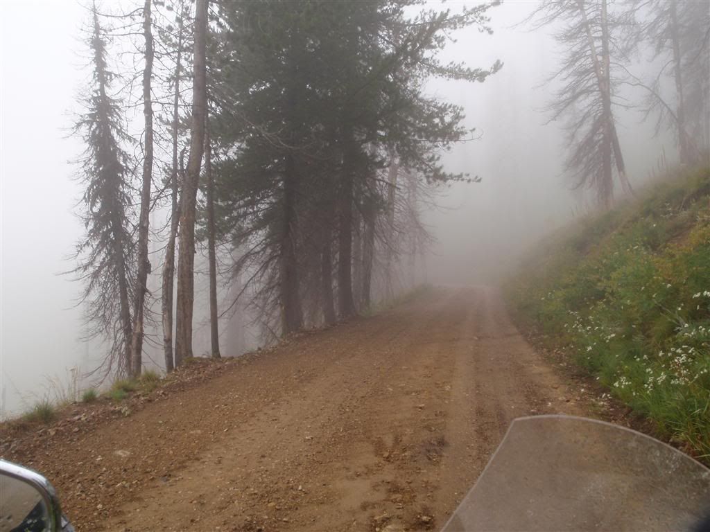
Always a good sign! The roads started out dry, but as the elevation climbed, everything to progressively more damp.


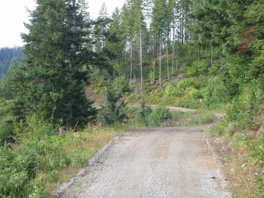
Seeminly frequent rain and fog made a lot of things very slick.


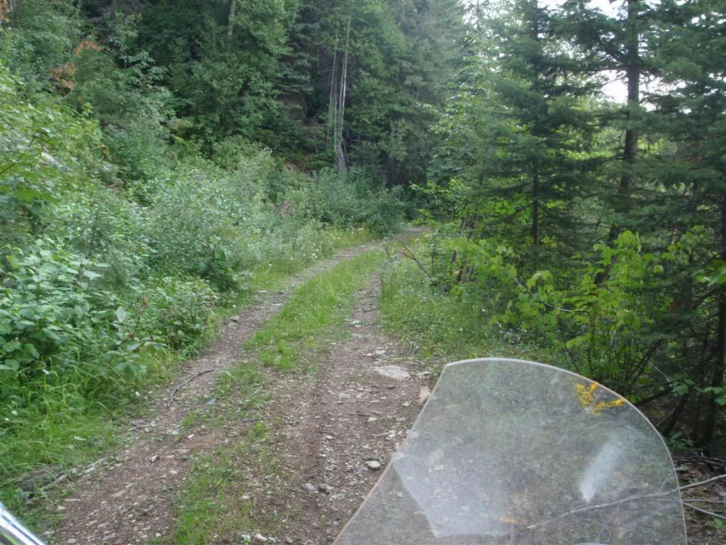
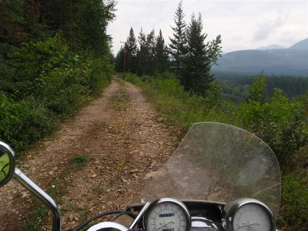
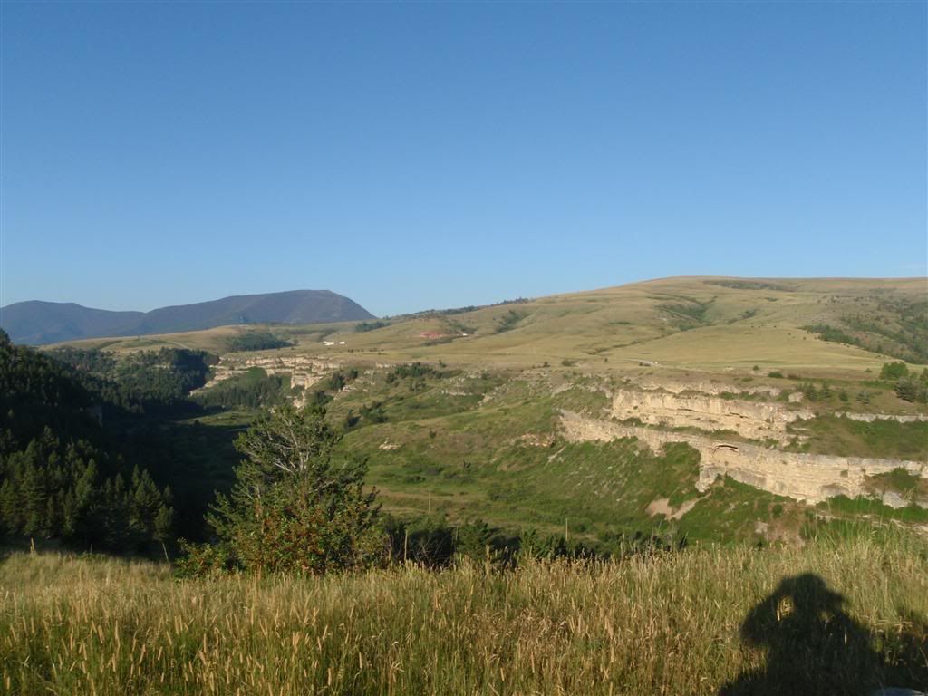
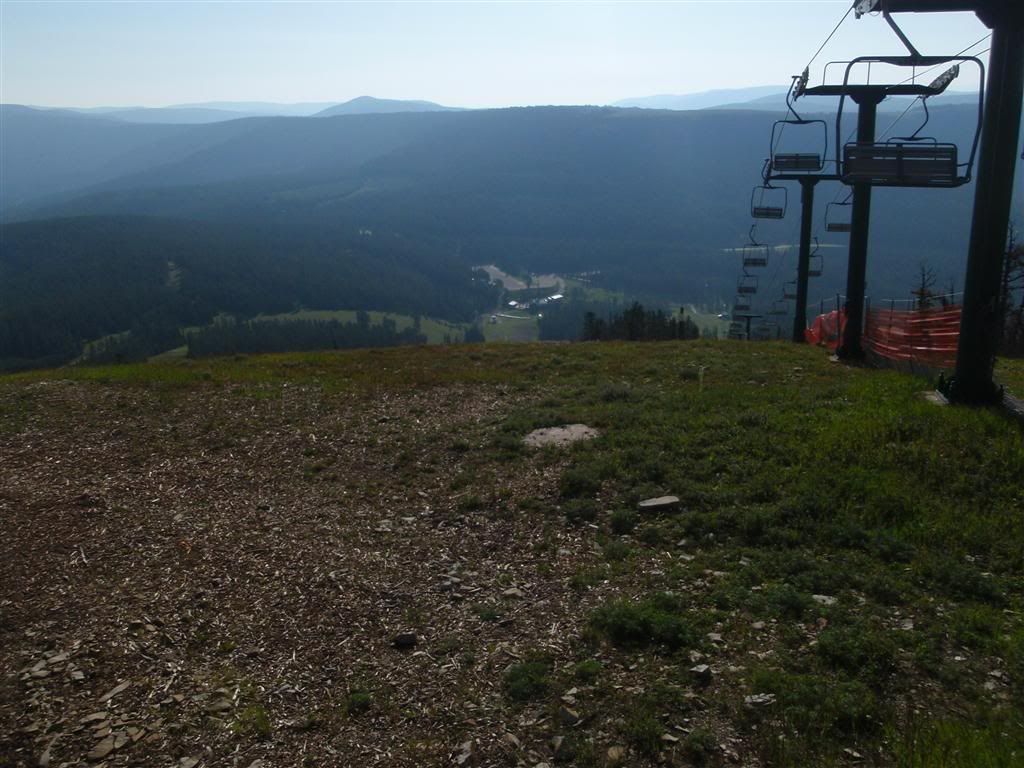
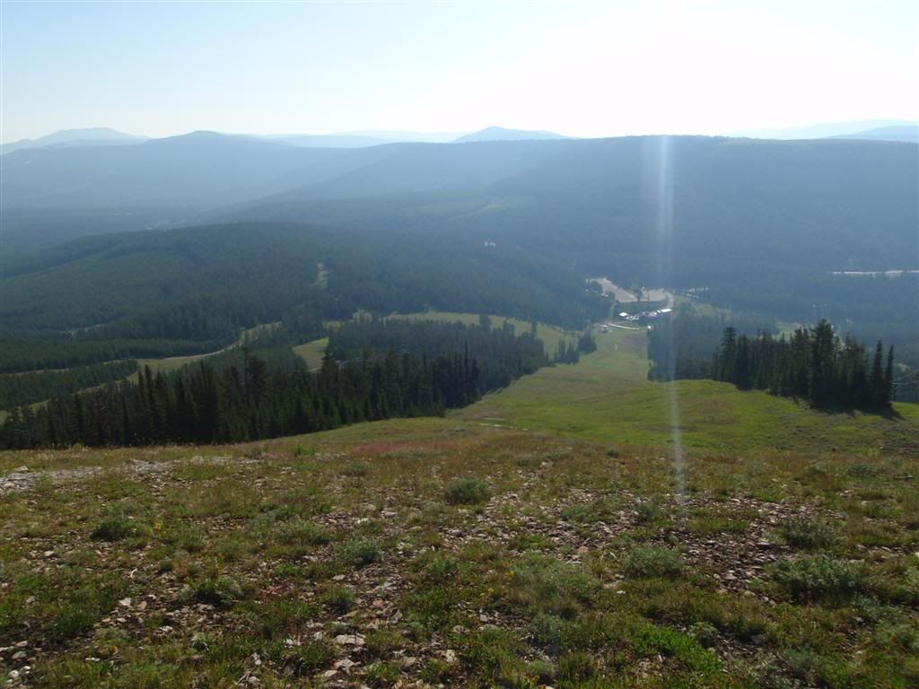
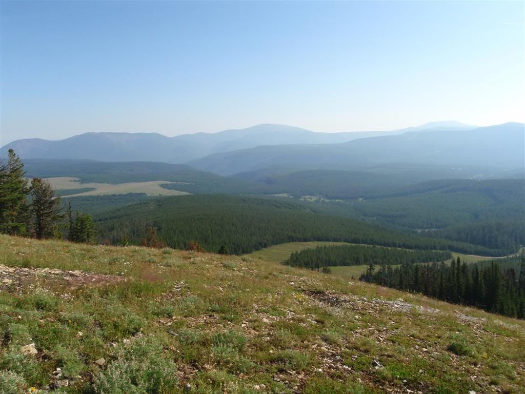
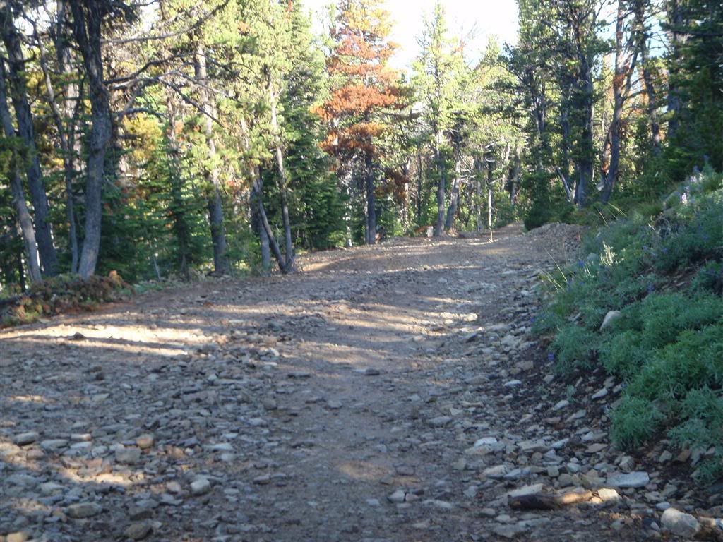
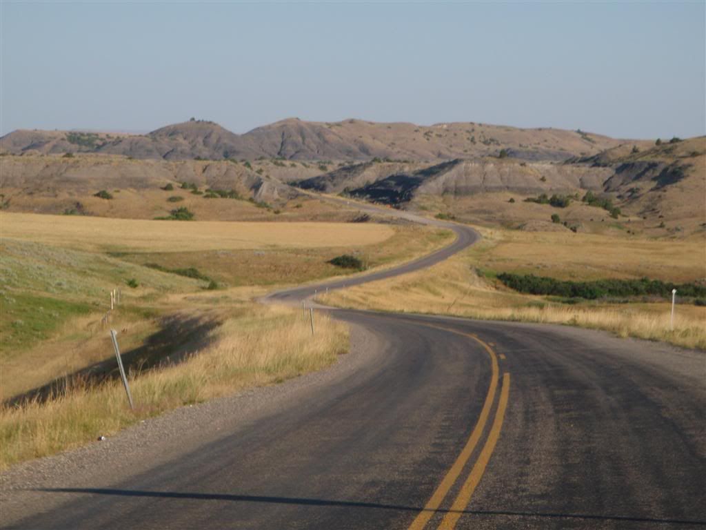
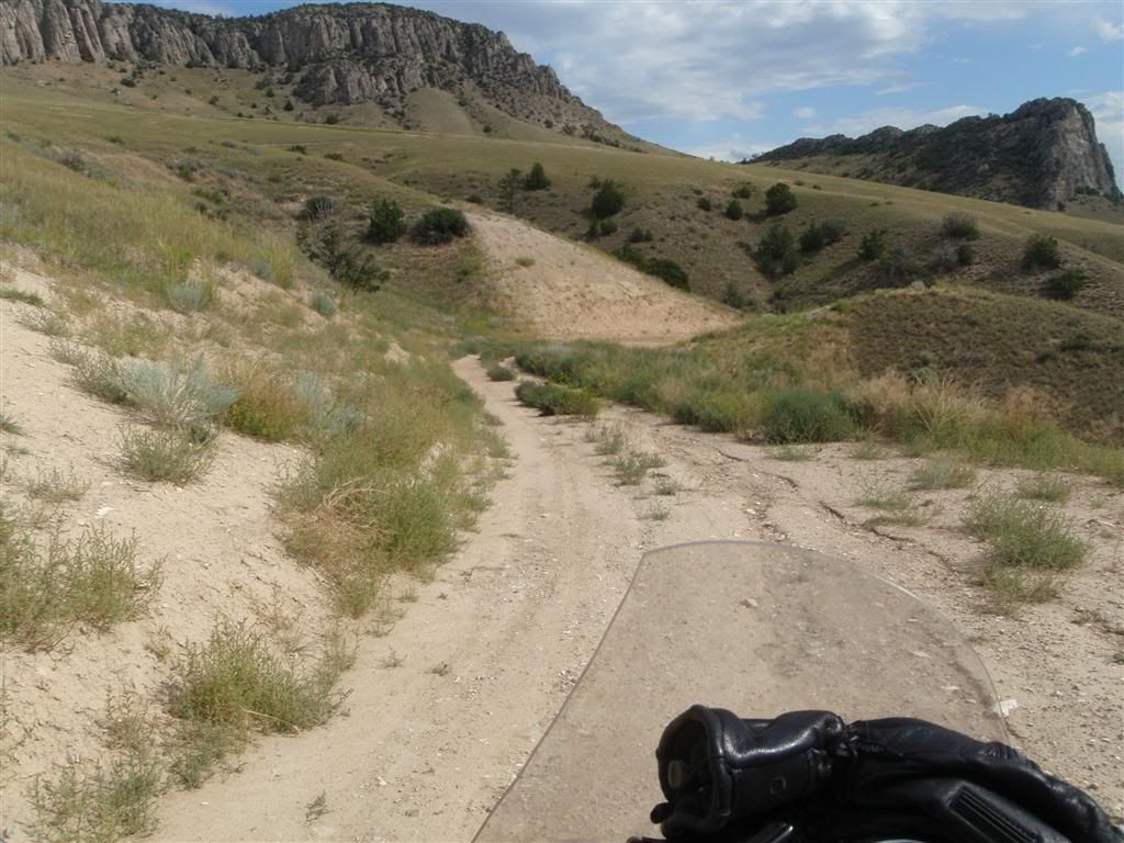
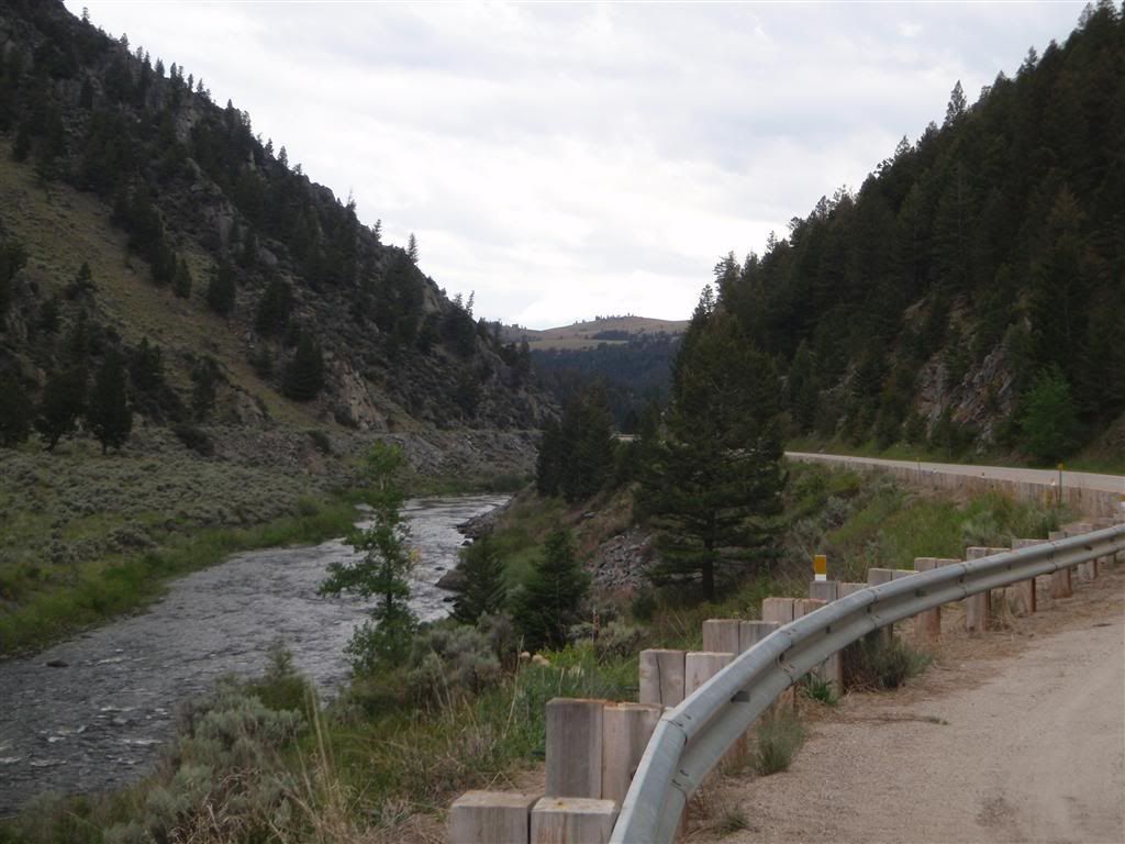
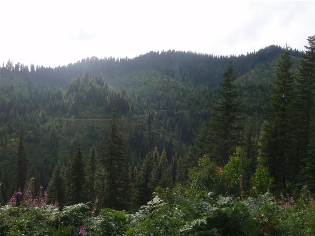
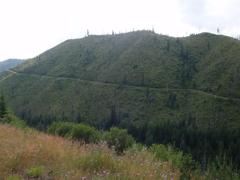
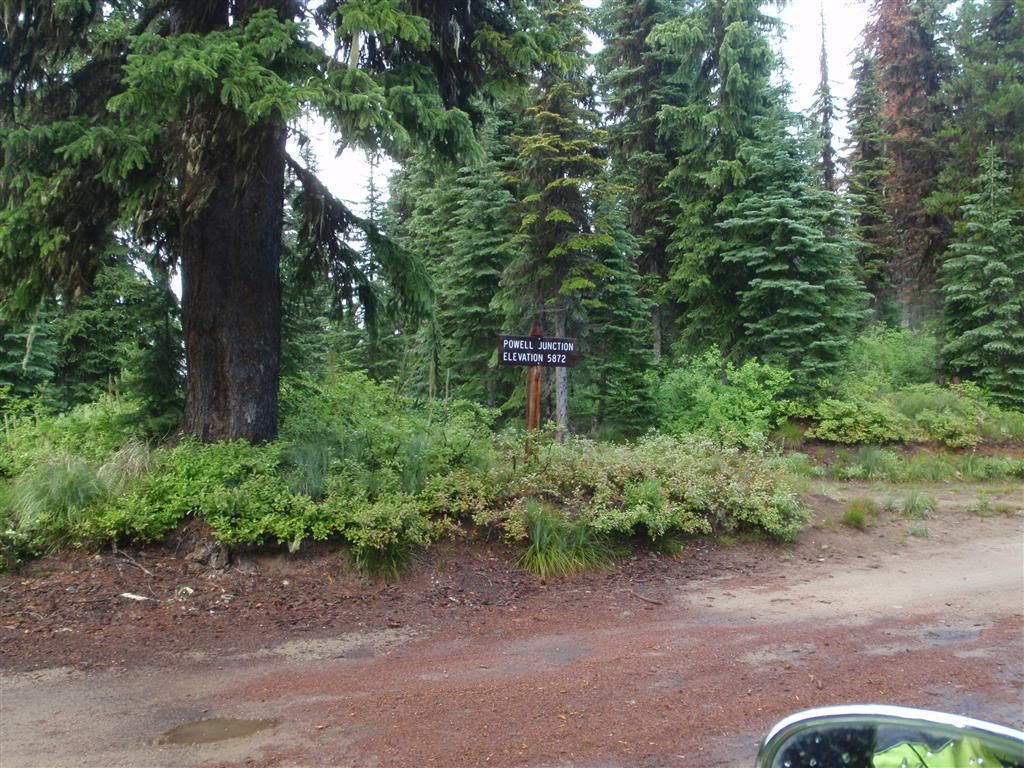
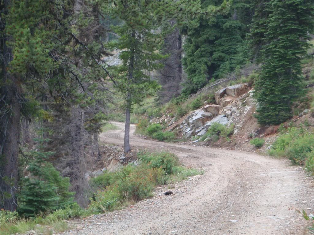
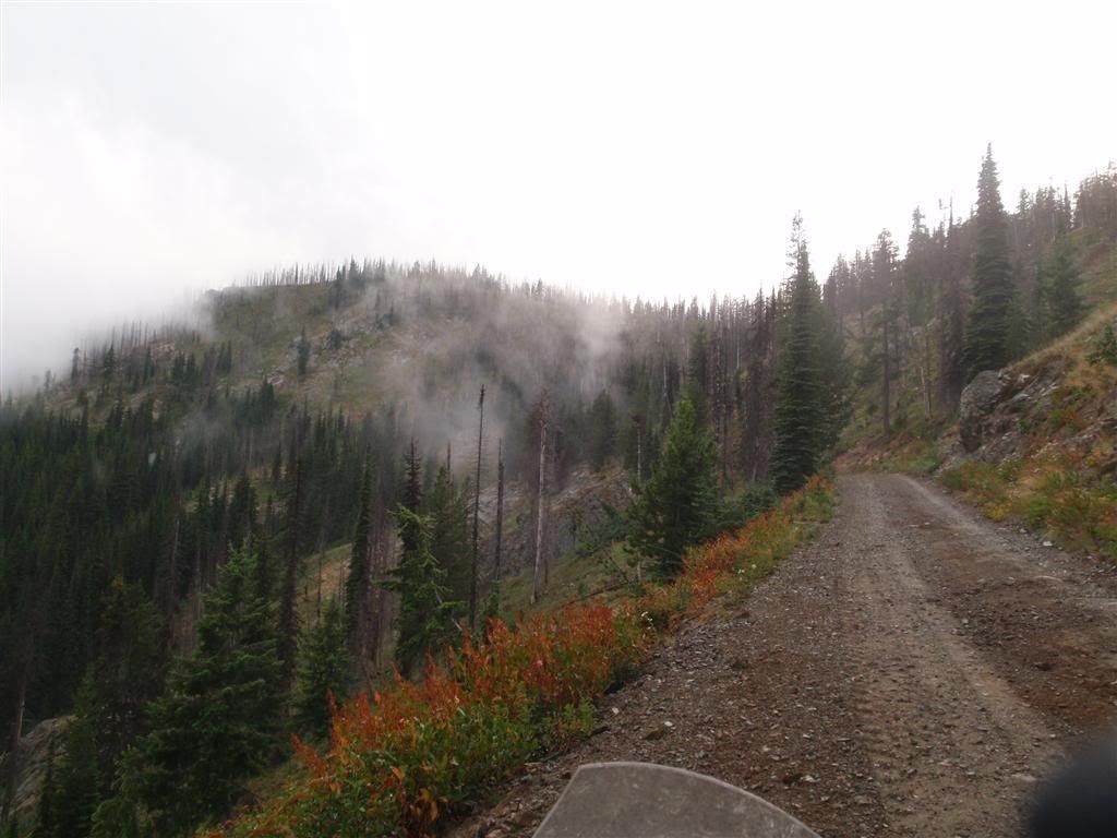
Rt 12 stays at the bottom of the valley floor, but the Lolo motorway rides the ridge lines.


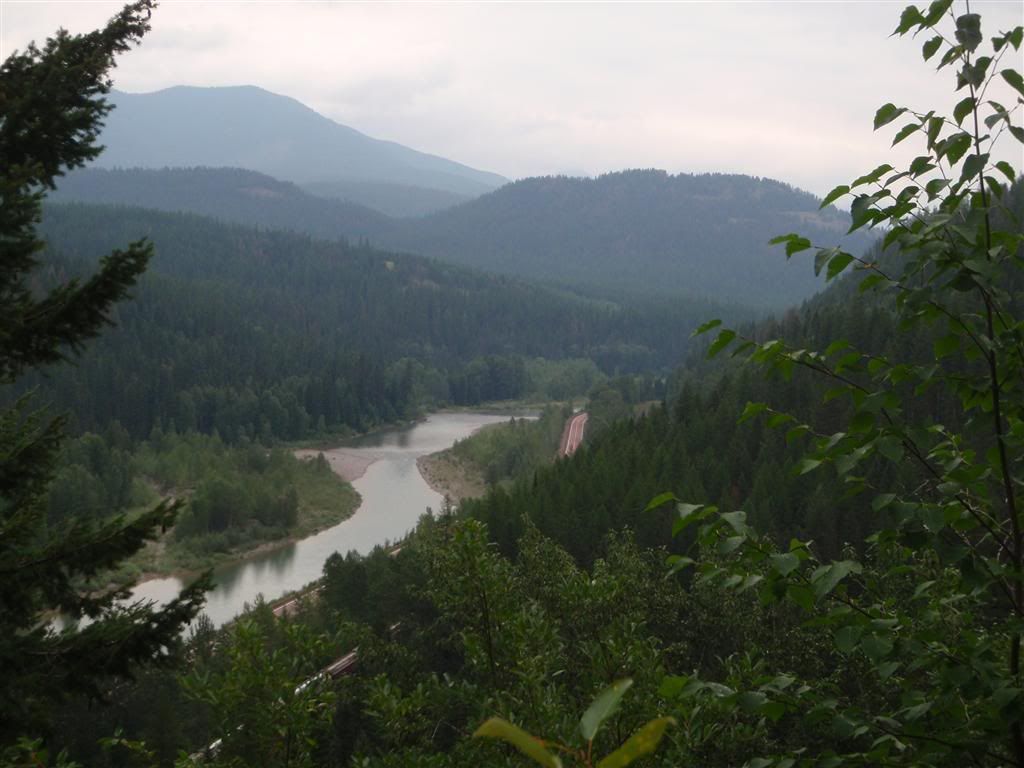
But once you make it up there, are you ever rewarded.


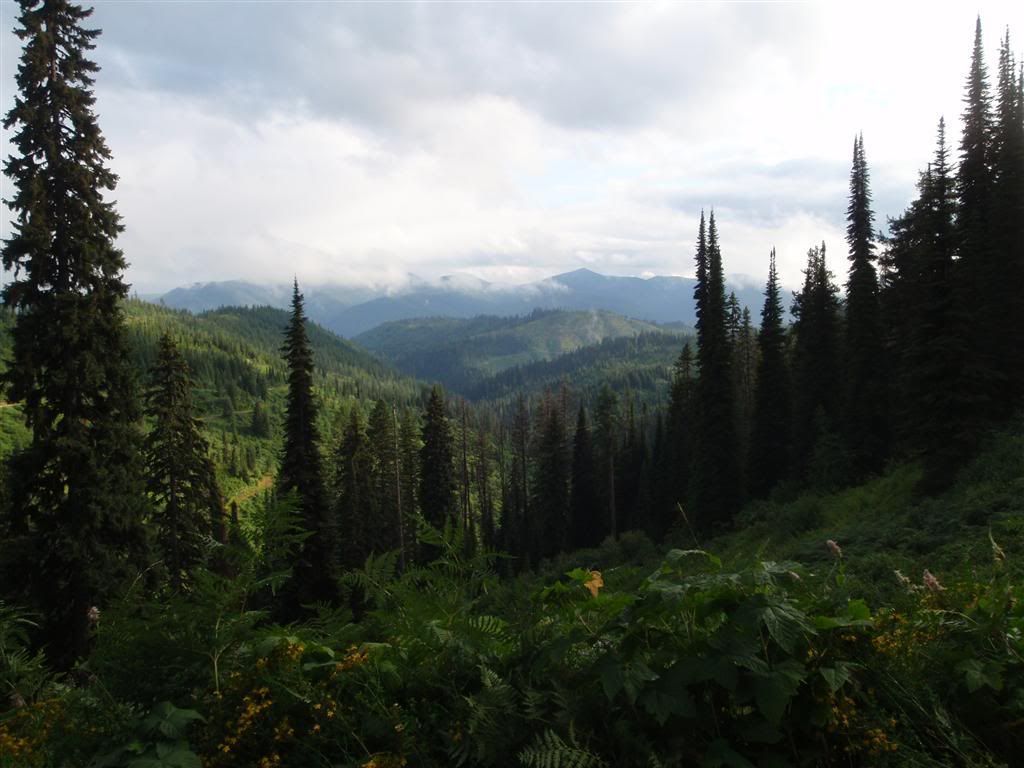
(VIEW THIS LARGER!!!)

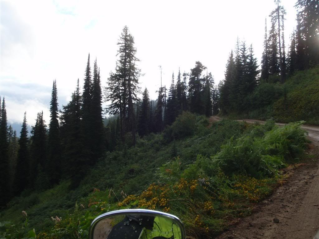
This road is absoultly breathtakingly perfect. I could not have asked for anything better. It was remote, it was rugged, it was challanging, and there was no one else around.


Did I mention that it was cut into the side of some pretty serious hills? Best not to go flying off the road here.


Well, I mean, you could quite literally fly off it, and get some decent air time. But the landing would be harsh.


There's nothing I can say to do this road justice.


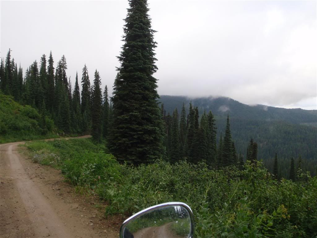
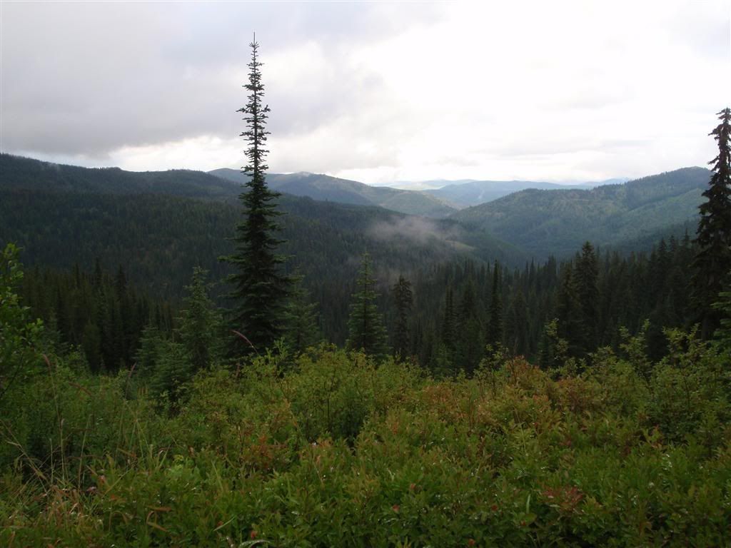
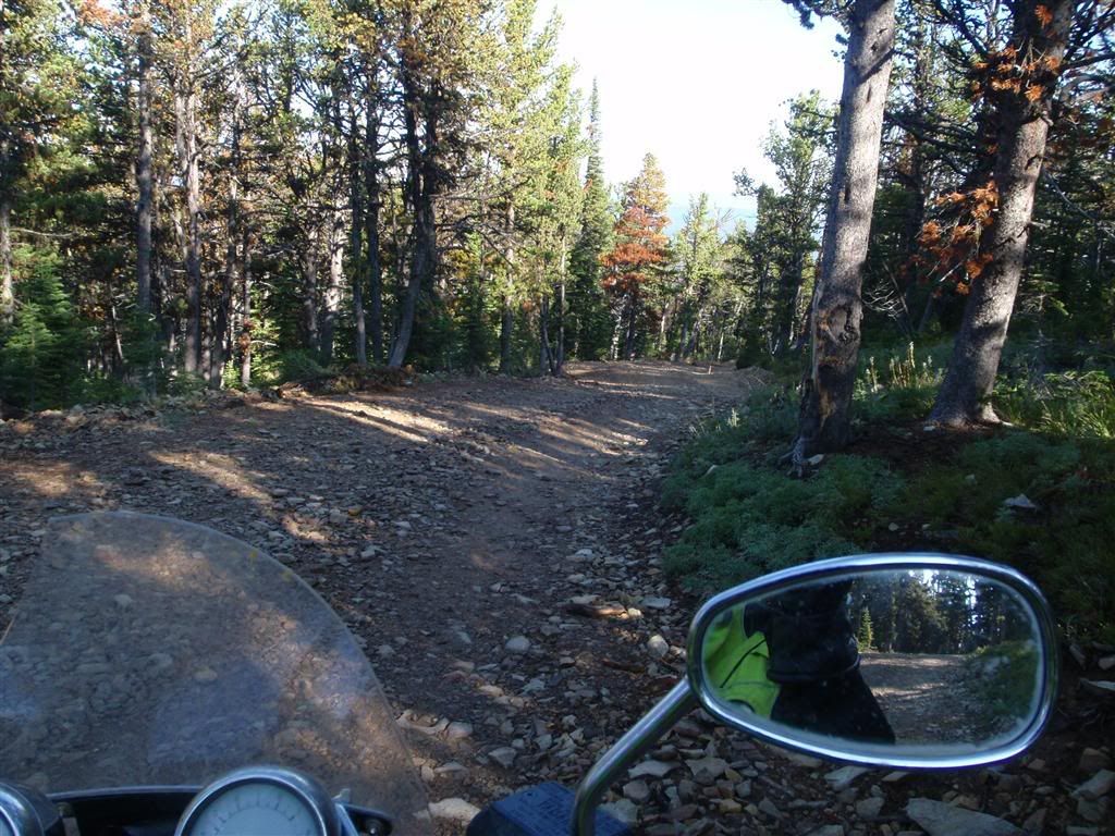
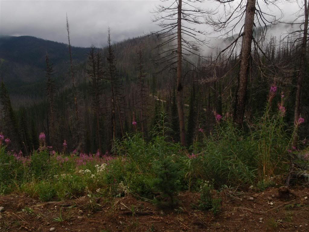
Not only was it scenic, but it was really gnarled. This would be a blast on a decent grippy dirt bike.


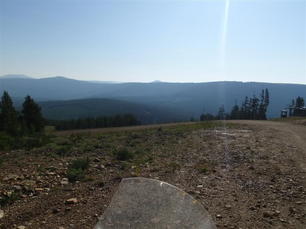
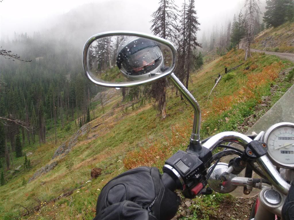
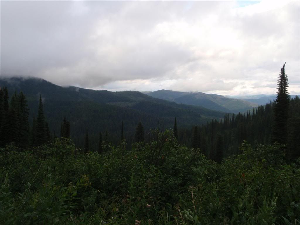
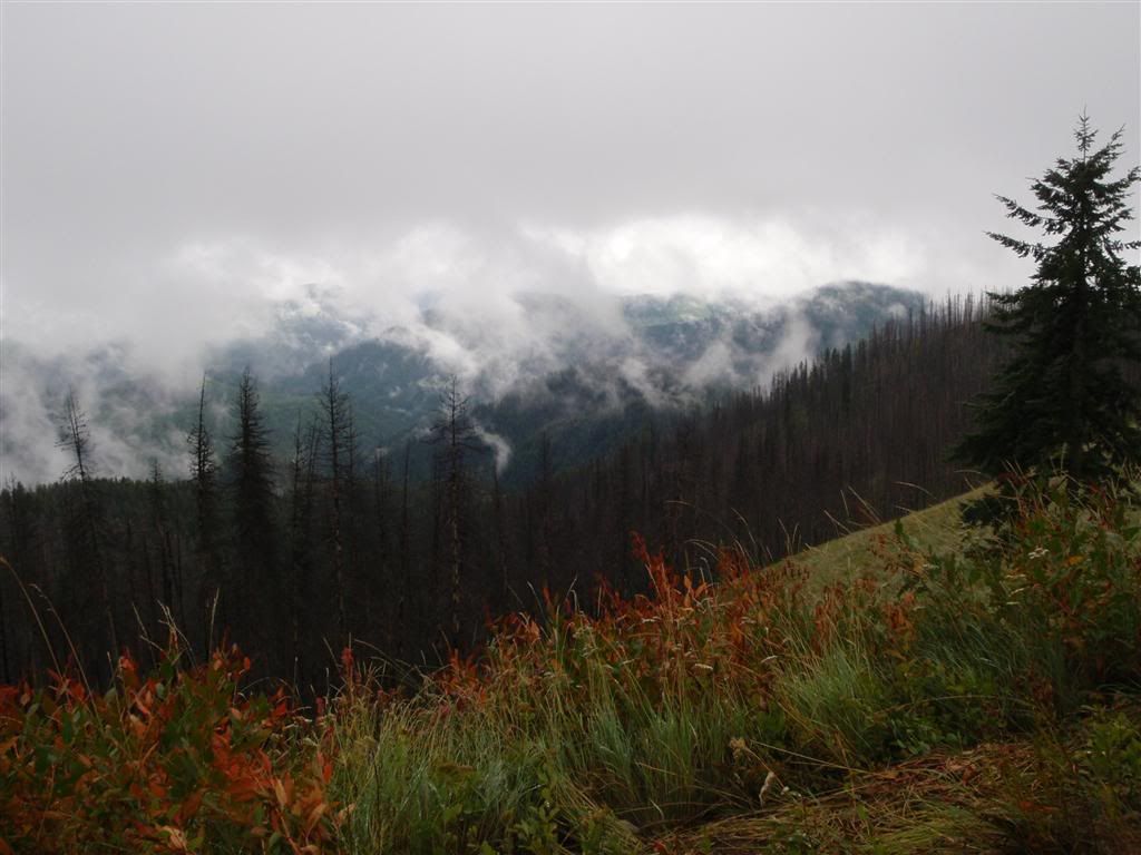
As the elevation got higher, the road was often between two layers of clouds. Look down, and you couldn't see the valley floors.


Look up, and you could almost touch the clouds.


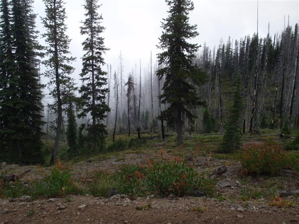
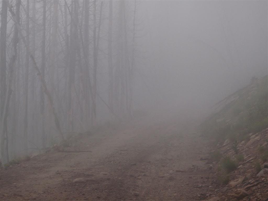
Soon the road was deep into the mist.


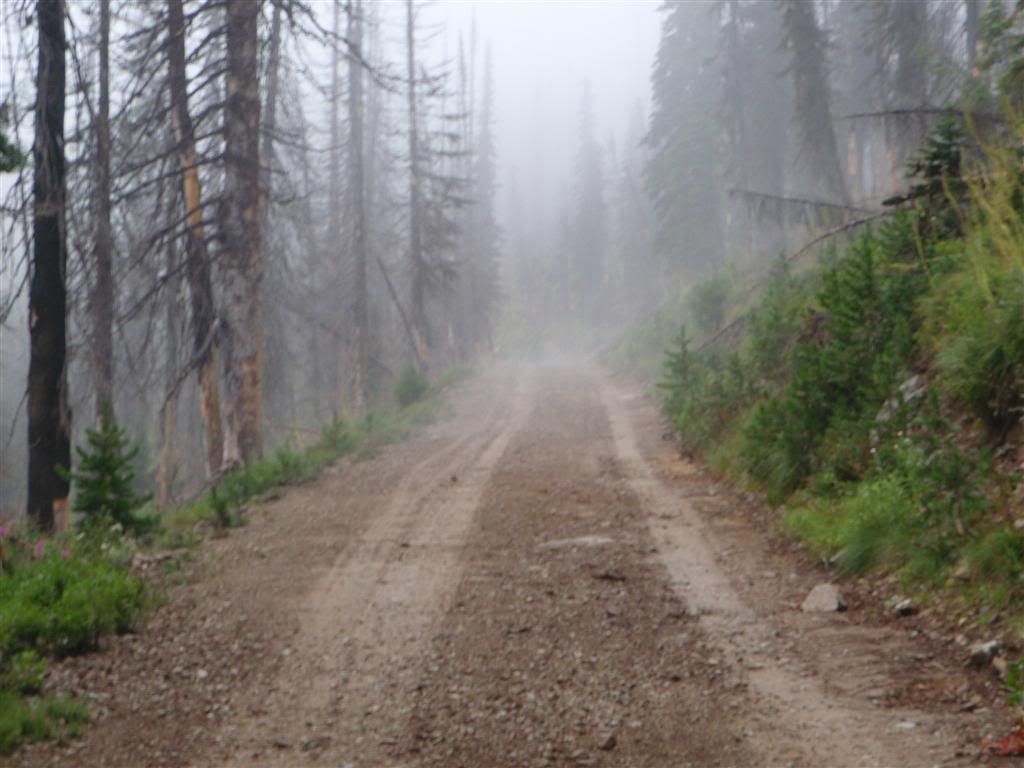
The combination of very dense fog, and stripped trees from semi-recent fires gave such an unearthly feel.


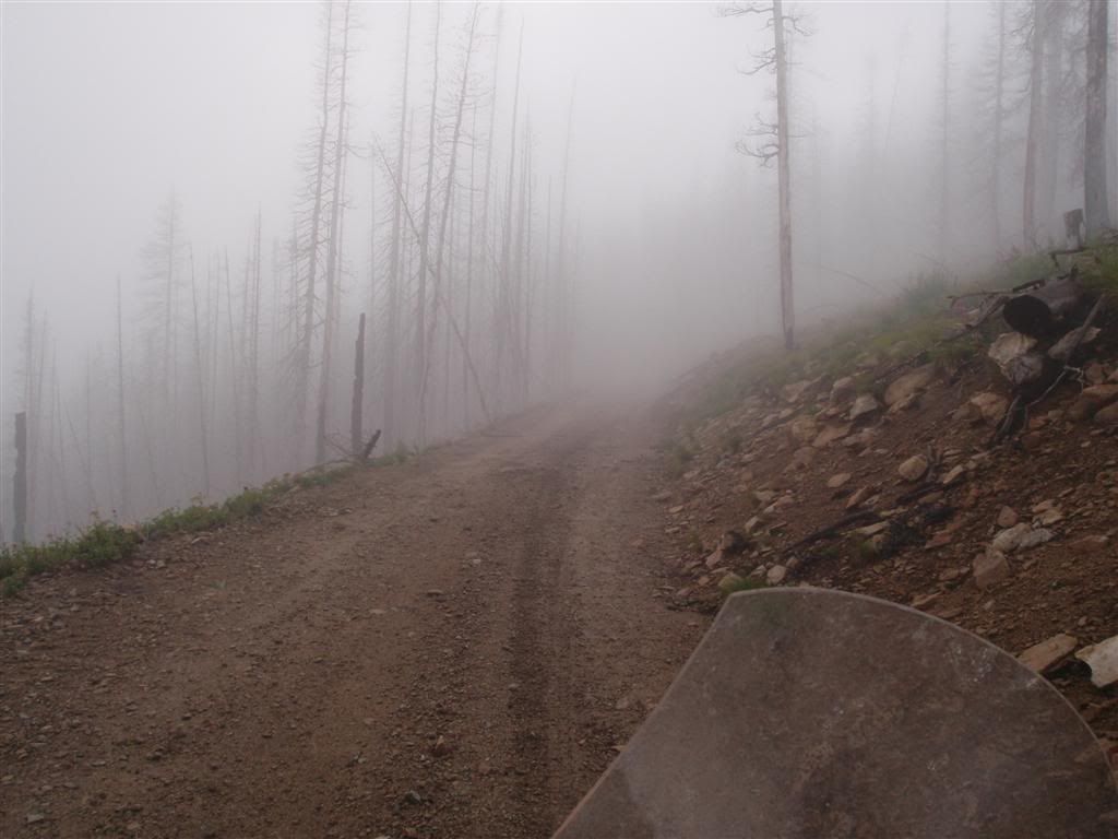
Sometimes I had to shut off the bike and sit there, just to remind myself that this place was real.


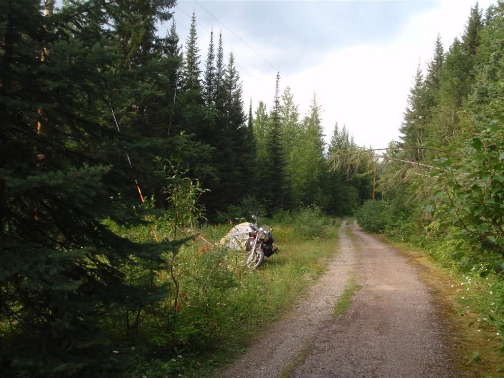
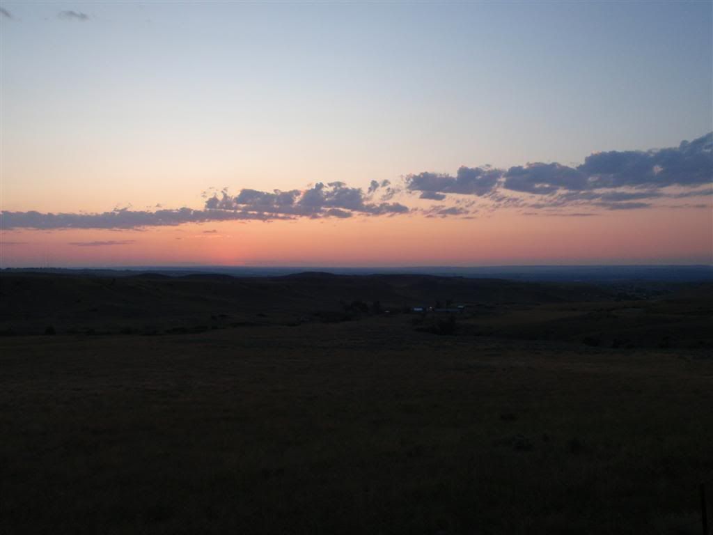
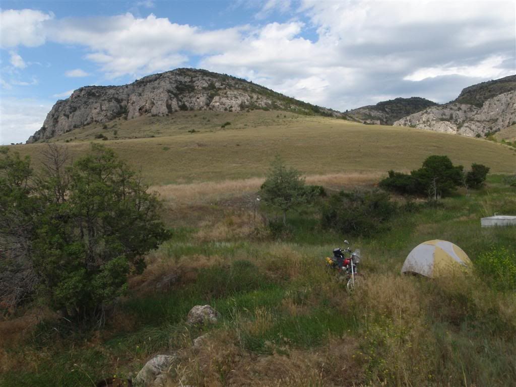
While this was a lot of fun, it was AMAZINGLY slow going. I don't have pictures of the really rough sections, because at the time I was too worried about not falling over/getting stuck to remember to pull out the camera. I made it about 40 miles on the road that day before it got dark, and I selected a clearing off the side of the road to pitch my tent in. (I swore I took a picture of my campsite, but I guess not).

That night brought rain, lots of it, almost without ceasing. At some times it would slow to a sprinkle, and occasionally increase to a downpour, but most of the time it was just a solid, steady, cold rain. And I do mean cold; my thermometer was reading about 38 degrees in the tent, and the oppressive humidity made it worse. This was just not a comfortable night, it seemed that no matter how many layers of clothes I put on, I couldn't get or stay warm. I wasn't to the point that I was dangerously cold, but I was quite uncomfortable.

And somehow, I felt farther away from the world then at almost any other point on the trip. I probably had been farther away from civilization at many points; up on the Dalton highway to Prudhoe Bay, through many parts of Canada, etc. So maybe it was just the constant rain, or the effort required to get here, but at very few times had I felt as distant from humanity as I did now.

It was brilliant. Sure, I was cold, and kinda damp, it was VERY dark, and bears probably outnumbered humans by a good ratio in the surrounding 20 miles. And to top it off, it was going to take a lot of riding until I was back to someplace warm and dry . . . but it was brilliant.


The next day still brought rain, so I stayed holed up in my tent for a while. I made breakfast out of my last two packets of oatmeal and hot chocolate, and settled in to wait the rain out. It never fully stopped, but at least there were some moments where it was only slightly sprinkling. I took advantage of one of these brief interludes to continue on.

As I puttered on the rain turned into more of a constant drizzle, or fog. Rolling slowly through these roads, with these tall trees and the fog illuminated by the sunlight that seemed only a few feet above was majestic. It felt like an environment out of Myst.


When I did drop out of the clouds, I could often see the road laid out in front of me. Sort of.


I stayed up in the hills, scraping the bottom of the cloud layer for the next few hours.


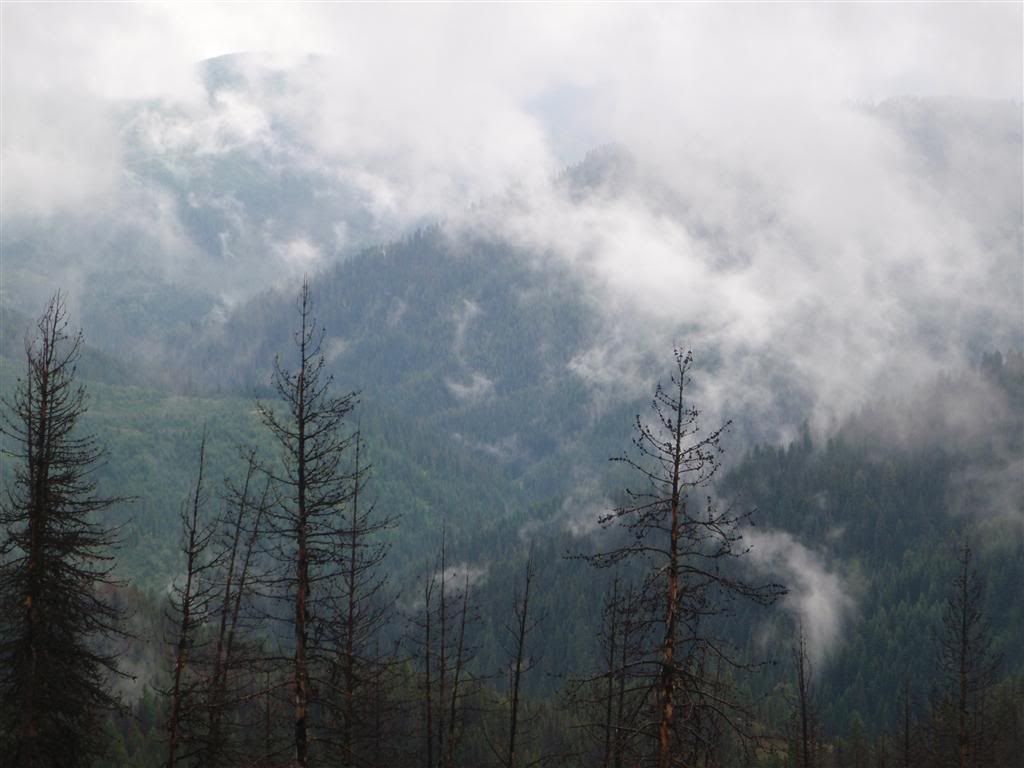
What a magnificent place.


While I probably could have gotten most of the way to Oregon on forest service roads, I was still on a schedual. Eventually I retired to the asphalt, although I was soon wondering if I'd have made faster progress sticking to the trails.


As the roads dropped farther out of the moutians, the sky started to brighten up and provided some very pretty photographing opportunities.


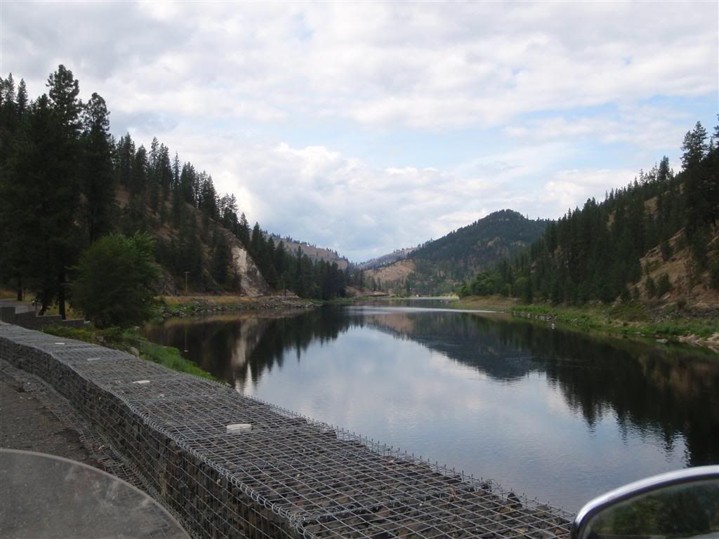
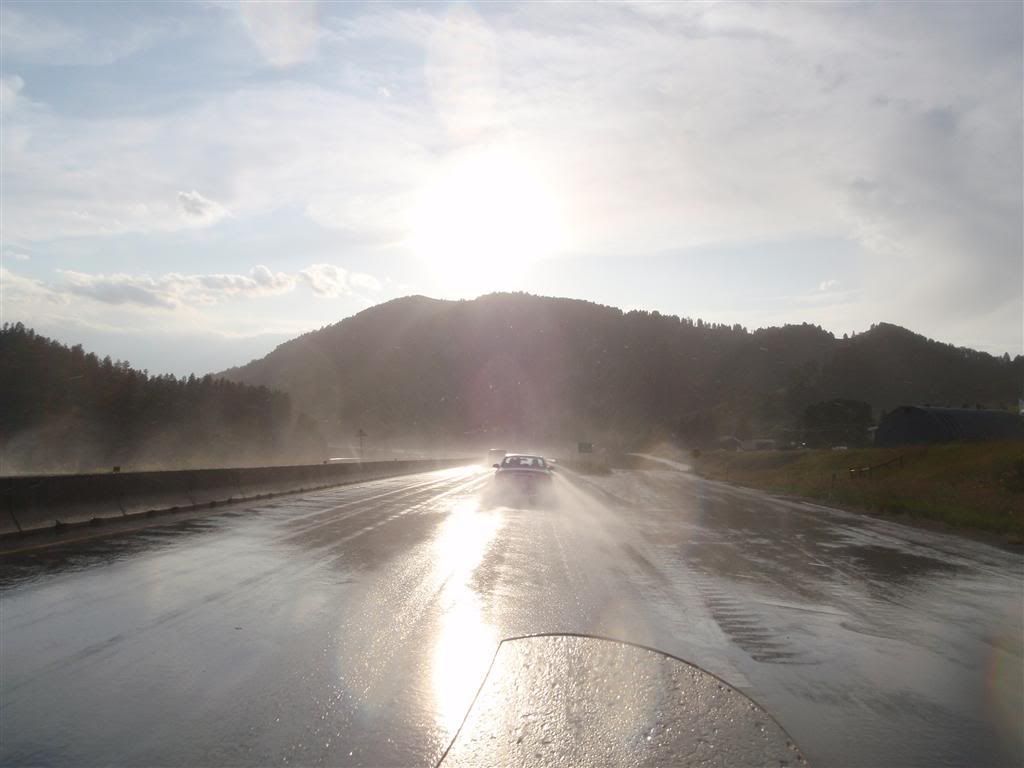
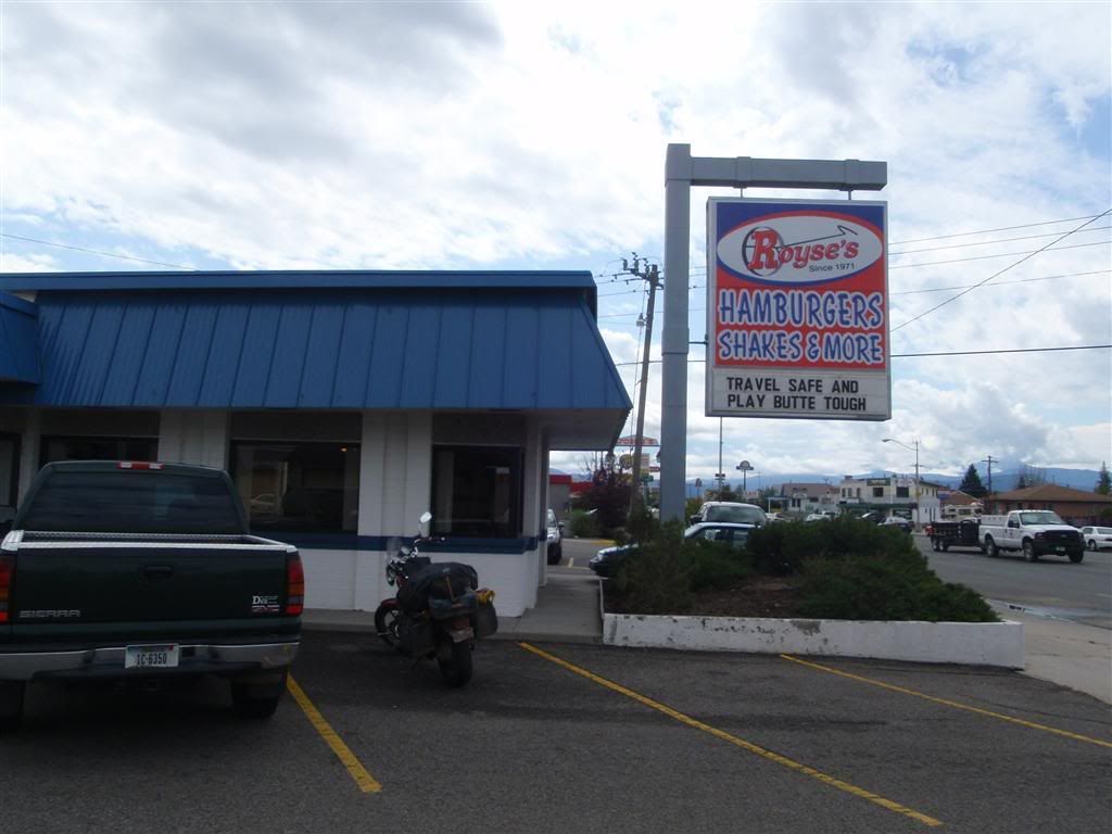
I joined back up with Rt 12, taking it all the way to Lewiston, on the Washington border. It was much warmer then it had been in the hills, and blessedly dry. I draped my suit over my bike to let it all dry out, and headed into a diner place for dinner.

Hrm . . . I hadn't eaten a real meal in two days; I hadn't eaten anything the day before and this morning had been a bit of oatmeal and hot chocolate. I was starving. So I ordered the largest hamburger on the menu. A . . . two pound burger?


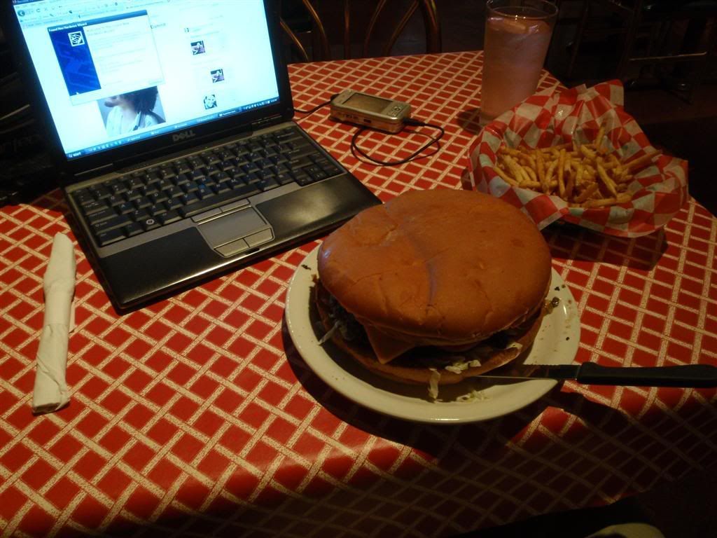
(Holy shit that thing is the size of my computer)

The waitress looked at me funny when I ordered it. "Uh . . . you know that usually is ment to be split between two or three people, right?" she asked. "Hrm," I said "I guess you better get me some fries too, then. And some chocolate cake." Waitress: 0.o


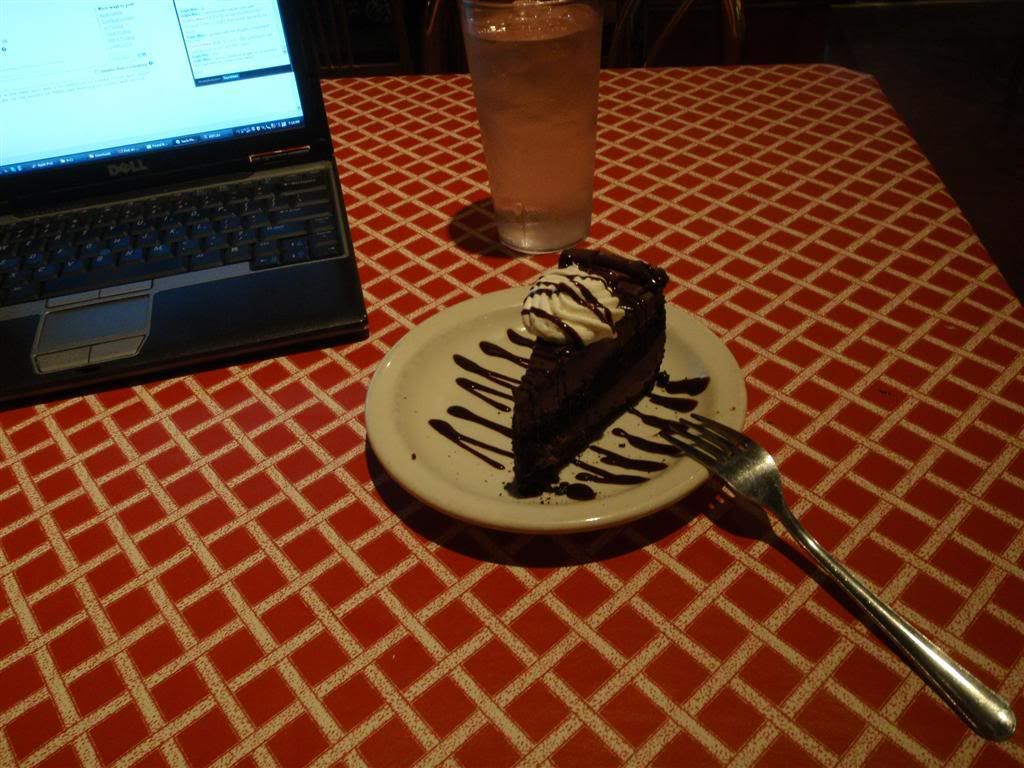
And every single bit of it all went into my belly. I felt good :D

Billings, Montana

I left Glacier National Park with a couple hours of daylight left, and started to head a bit more east. While my longer-term destination was to the west, to head down the Pacific coast, my short-term plans took me a little bit farther east. My destination in a few days time was Billings, Montana, where my sort-of-girlfriend-it's-complicated was making the 1600 mile drive out from Milwaukee to see me for a couple days.

I exited Glacier on the west side, and headed down Rt 2 along the southern boundary of the park to look for someplace to spend the night. I didn't know it at the time, but technically this was National Forest land, so I didn't need to put as much effort into camping as I did. There seemed to be a myriad of trails and tracks leading off from the main road, so I picked one at random and headed down it for a while, just to see what was up with it. There were some good clearings to camp in, but I didn't want to get set up only to find out that I was along someone's driveway or something.


Best I could figure, this was a service road for the power lines.


For the most part, it stuck close to Rt 2, cut into the hillside a few hundred feet above the main road, looking over the river.


For the most part, the trail was quite passable. Some large logs that had fallen across it had been (fairly recently, from what I could tell) chainsawed out of the way, which made me a bit more suspicious that this was someone's maintained driveway or something. At some points the stones got very large and rough, but I was usually able to pick a clean path through. And it was always quite scenic.


After a few miles, I'd taken the trail as far as I could; it was washed out in a section, and while I MIGHT have been able to get the bike over it okay, I didn't want to push my luck.


And with this part of the road gone, and nothing else of note besides power lines along what I'd seen of it, I felt pretty confident that I wouldn't be pestered during the night. I headed back down the road a bit to one of the many clearings I'd seen, and set up for the night.


I was woken up that night at around 1am by an EPIC rainstorm. We're talking sheets, huge buckets of water and massive, deafening thunderclaps. And while we get enough of those sort of showers where I grew up in the midwest, they usually last a few minutes and then peter off to a more normal rain. But this one didn't let up for a long while, it continued to drench everything for at least an hour or to. I was happy that I'd camped up on the hill near large trees, and not down by the river. Through the rain the tent held up just fine, and i stayed comfortable and dry through all of it. The next morning there was still evidence of the rain, as most of the ruts in the road had turned into very deep puddles.


I kept going east on Rt 2, which while it stayed in the mountains, was quite pretty.


But it didn't last. After an hour or so, it gave way to plaines.


Looking on a map, I could see that there were some nice roads in the direction I was heading, but it was going to take me a solid day to get to them. Ah well. I put in my earbuds under my helmet, and listened to a few episodes of This American Life on my iPod.

Stopped at a store in some po-dunk town for snack food. Before leaving Canada, I'd spend my last canadian dollars on some beef jerky, a luxury item that makes great road trip food, but is always suprisingly expensive. But having dry food in the tank bag that you can eat on the road is very nice, so I tried to go a healthier route this time.


It turns out that I didn't like dates that much. But the apricots were good, I went through them pretty quickly.

Nothing much interesting to note for the rest of this day. In an effort to keep myself from getting too bored, I tried to take more back roads, which resulted in me getting gloriously lost on farm roads and having no idea where I was. Still straight and boring, but at least I felt like a little bit more of an adventurer on gravel.


Stealth camping in the plains is way harder then in the mountains. There's much less in the way of concealment, and almost all of the land is privately owned. Fences everywhere, and nowhere to hide. I was searching for the better part of an hour and a half, and was getting desperate. Finally, just as the sun was touching the horizon, I found a semi-concealed spot behind a grove of trees off a rail-road access path. I had no idea if it was private land or not, but I was reasonably hidden and figured I could plead stupid if someone bothered me during the night.


But I was fine for the whole night. Occasionally the lights of a passing vehicle would throw shadows on the tent, but either no one noticed or no one cared. Still, I was out of there before the sun was fully above the horizon, just to be safe.

8-10-9

Today promised better riding then the previous day had. Within a couple hours I was back in mountainous country, taking Rt 89 south through Lewis & Clark National Forest.


Roughly halfway through the forest, Rt 89 passes by the Showdown Ski Area. Usually commercial entities have limited functions inside national lands, but I guess Showdown was grandfathered in, and operates on a special lease. I saw a couple of tourist signs advertising a small road that headed up to one of the tallest peaks in the area, where there's a fire station lookout. And I'm not one to ever turn away from a poorly-maintained forest service road!


One of these days, I'll get a proper dual-sport bike that is actually built for this sort of stuff, but for now, going slow with some fancy clutch work got me through it okay.


The watch tower at the top. The little sign said that visitors were welcome to come up as long as the fire marshell up top said it was okay, but I didn't feel like pestering him. I did head for a bit of a wander though. Ski areas are so weird when they're not covered in snow.


Nice views, though.


Getting back down the road was a lot harder then getting up. Going uphill you can always give it throttle to help stabilize the bike, and excess speed is bled off quickly. Going downhill, there's always the worry of locking a wheel, especially on surfaces this loose.


Another shot of the ski slope on the way down.

Once I got out of the National Forest, it wasn't very interesting.


Although one place I stopped for gas had an interesting way of dealing with people who bounce checks. I guess this is an advantage of small towns, public shaming might actually work.


And while I don't remember it being cool, I must have been sort of chilly, as in this picture where I was stopped for construction I was wearing my heavy gloves. Huh.


I made it to Billings, but the girlfriend-thing wasn't due into town until the next day. I hung out at the Library for a bit, updating the blog the best I could, and then headed south from the town to try and find someplace to camp.

Even though it was hilly, everything seemed to have fences around it. It was getting late, very late, and eventually the sun set and it got quite dark with me still not having anywhere to sleep for the night.


I finally made do with a small state park, which had signs all over it saying "DAY USE ONLY! NO OVERNIGHT CAMPING!" Er, sorry 'bout that.


Twice during the night, I head a pickup truck come through, and saw it's lights flash over my tent. But if it was the police, either they didn't notice or didn't care, because no one bothered me. I was gone as early as possible though, and headed back to Billings. The roads weren't aggressive, but now that I could see them in the daylight they were kinda pretty.


The girlfriend got into Billings sometime later in the day, and we spent the next couple days holed up at this stupid cowboy-themed hotel. Whatever, it was the cheapest we could find and it had free internet.

During this break in traveling, I finally got around to going to the optometrist to get a new prescription, and some new sunglasses.


Oh yeah. You're totally jealous of my pimp new shades.

And as much as three days together wasn't enough, she had to get back to Milwaukee, and I was way behind schedule if I wanted to make it to the Grand Canyon before going to Burning Man. So on 8-13, we bid our farewells, and headed off. She went east, and I went west.

And right at this point, I made a really stupid mistake. I mean, I guess it was logical, given that I really needed to get to the west coast quickly, but . . . I was like 50 miles away from Yellowstone! And I didn't even drop into it just for a day?! Stupid stupid stupid . . . even worse, for the first part of the day, I stuck to the slab. Good ol' I-90 :( To make it more fun, there looked to be storms in my path.


As usual, mountains created their own weather systems, trapping clouds and heavy rain at the high passes. The late-afternoon angle of the sun, combined with weird wind patterns, gave the very strange experience of riding in a downpour, and blinding sunlight at the same time.


Once I got over this range, the skies calmed down a lot. As I looked back, I was happy I wasn't still in the hills.


Weeeee! Okay maybe there were still some small hills.


Camping that night was a field that didn't seem to be protected by any fences. It was accessed via a bad road that had many cracks that were EXACTLY the width of my front tire! Perfect.


I did dump the bike once due to getting the front wheel caught in one of these ruts (stupid target fixation), but neglected to take a picture of it


Once I was a bit higher in the hill, the road smoothed out some, and I found some trees that sort-of concealed me from the road.


I kept pushing west on I-90 the next day, stopping in Butte for lunch. Haha, Butte . . . Yes, I am that mature. I was giggling for at least an hour at every single road sign or advert. Because I'm a grown-up.


Alright, I'm going to break up this post here, just to make things easier to manage. More in a bit.