Oil was discovered on the north slope of Alaska in the early 70s, just as the oil crisis hit. Given the political climate and the realization of just how dependent on foreign sources of oil we are, the construction of a pipeline from Prudhoe Bay, on the Arctic coast, all the way across Alaska and down to the ice-free southern coast was approved quickly. A service road was built to help move all the drilling and servicing equipment to the North Slope, and in 1997, that road was opened to the public. It runs from Fairbanks all the way north to the Arctic Ocean, mostly following the Alaska Pipeline for most of the way, eventually ending in the "Town" of Deadhorse on the coast. This was the road I planned to ride.
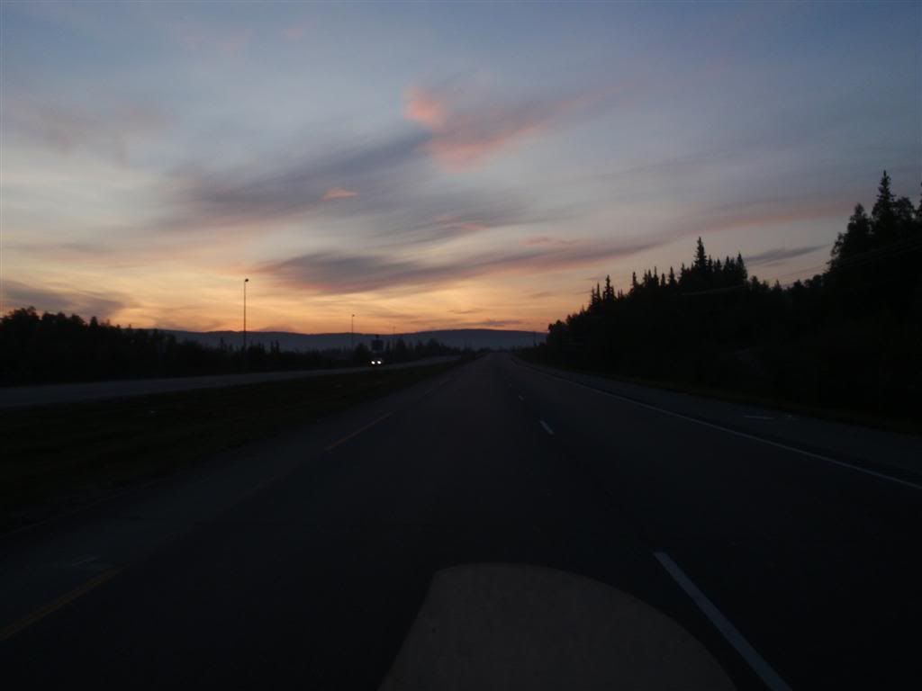
I headed in the direction of Fairbanks where I hung out with and got fed by a goon from SA, and later that night, I headed north, up out of Fairbanks in the direction of the Arctic Ocean. There's a bunch of forest fires burning in the Alaskan Interior, and while the level of smoke/smog varies, it does make for some impressive sun . . . sunsets isn't the right word, as this picture was taken at around 1am. But impressive sun-scapes.
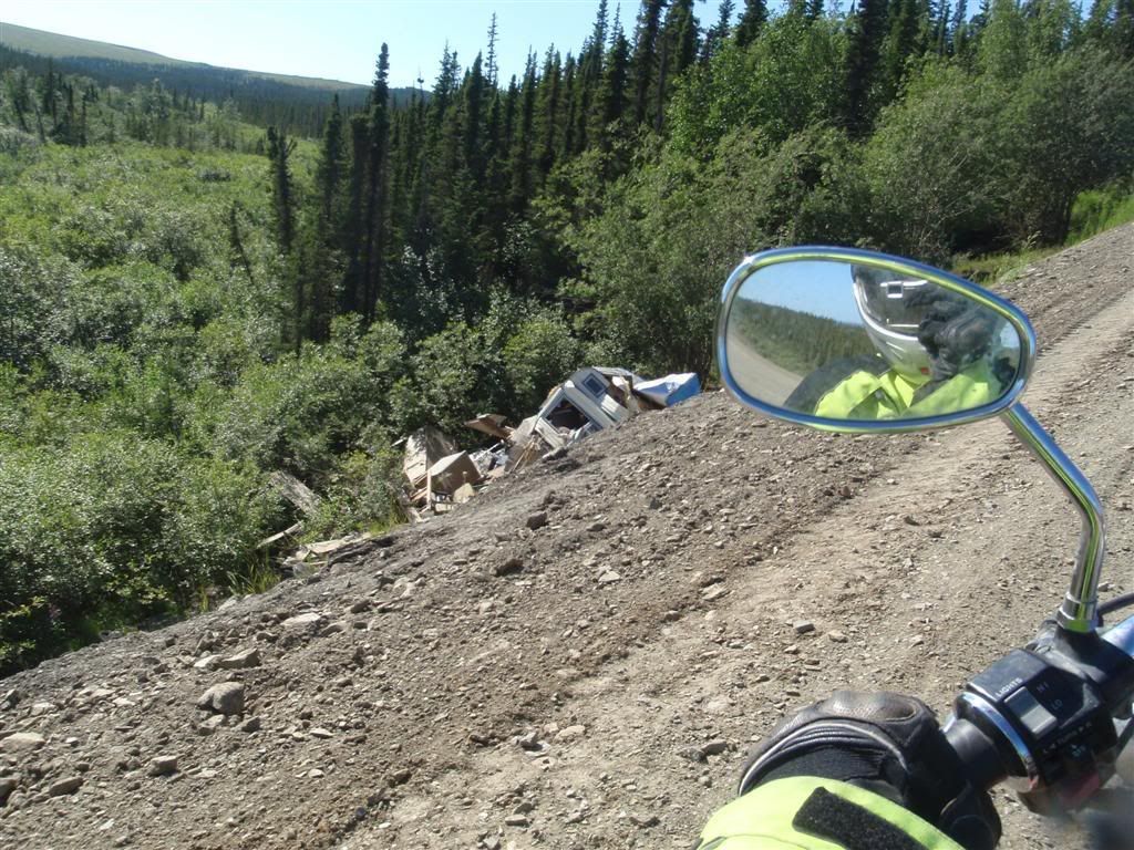
I headed down a gravel side road at some point, which was one of the rougher roads I'd been on. It was made up mostly of baseball-sized rocks that loved to toss my front tire in any and all directions, and gave me a good shaking around as well. I had to go for about a mile on this before I found a clearing to camp in.
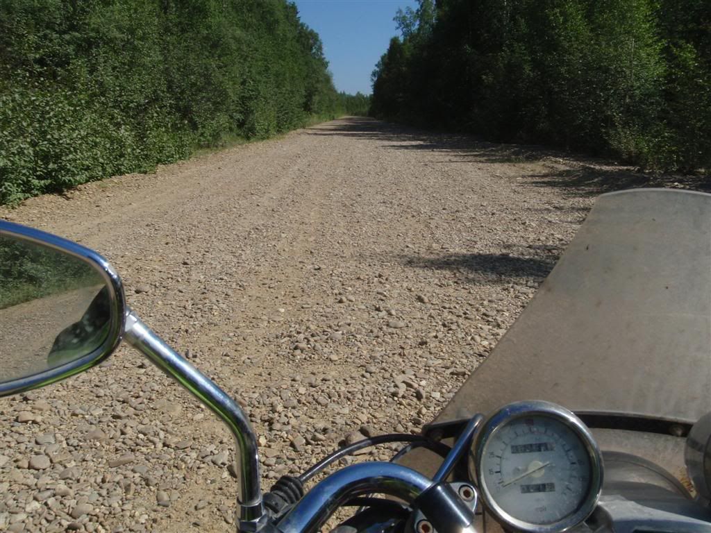
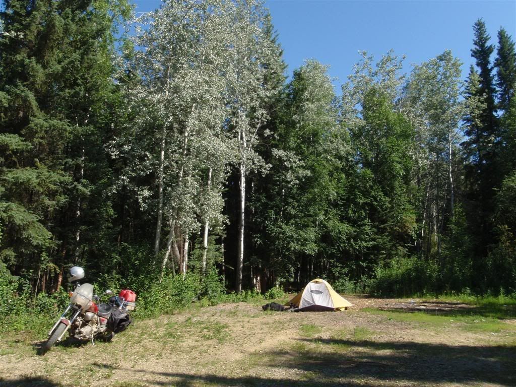
(I actually took those photos the next day as I was heading out, but whatever)
Going north was good, smooth, paved road, providing occasional glances at something I would be seeing an awful lot of in the next few days.
About 70 miles north of Fairbanks, I saw the turnoff that I'd been looking for.
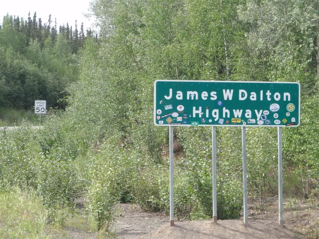
Covered in stickers from motorcycle clubs, mostly.
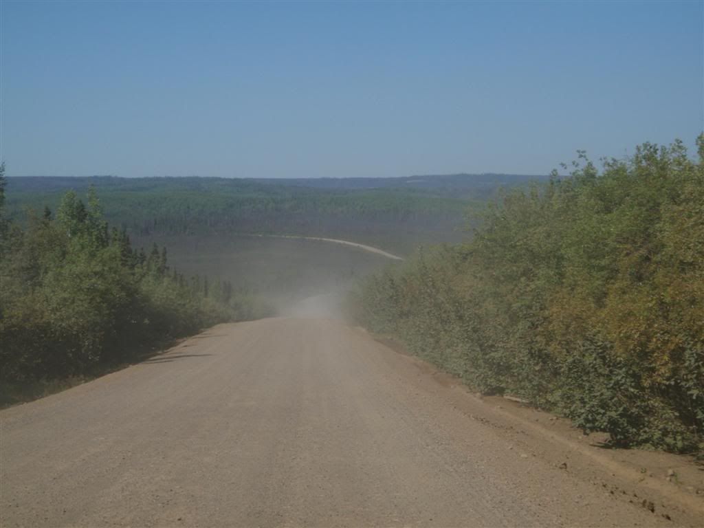
Immediately after the turn off, the road turns fairly rough. Rumor is that they purposefully keep the first fifteen miles or so of the road in lousy condition, to deter travelers who aren't really serious/able to deal with bad surfaces. It was mildly washboarded, and had some parts that had deep, loose gravel, but the worst part was the dust cloud kicked up by passing vehicles..
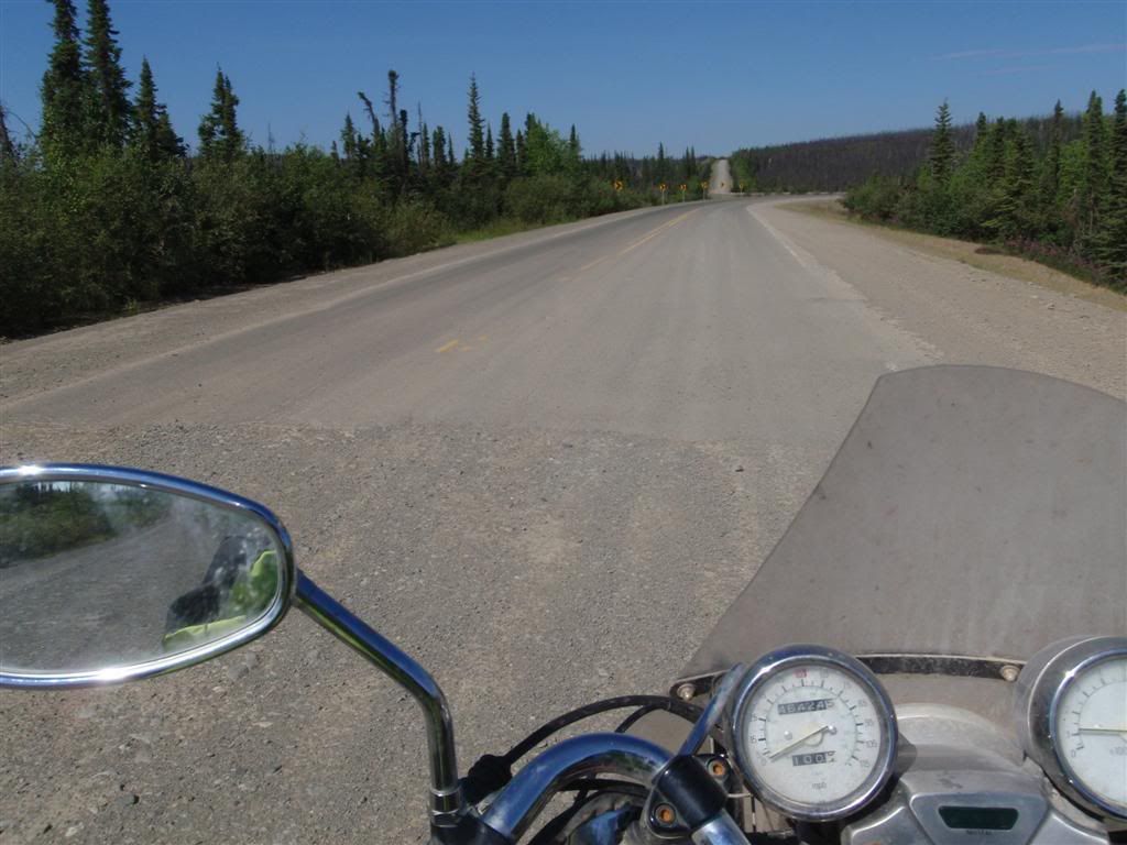
After about 15 miles, it did turn paved, and mostly stayed that way for the next hundred miles. There were some sections of gravel/dirt, but it was pretty smooth and in good shape, I could maintain 50mph over most of it without any worries.
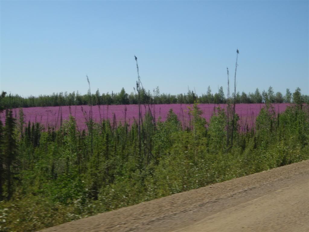
Huge sections of the landscape going north were a brilliant purple, for miles and miles. Fireweed, so called because it grows back very quickly after wildfires, was everywhere, turning large patches of the mountains magenta.
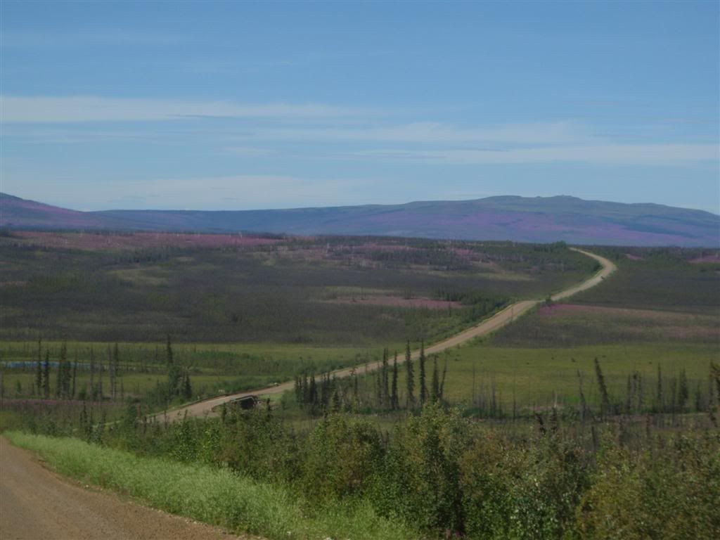
The hills here were gently rolling, with lots of veiws out over miles and miles of untouched forest.
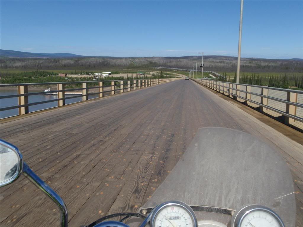
The road stayed mostly paved until I got to the Yukon river, which is traversed via a 6% grade wooden bridge. A hotel/gas station on the other side gives people a place to stop for fuel, but with the red reserve tanks strapped to the top of my camera, I was good for a while yet.
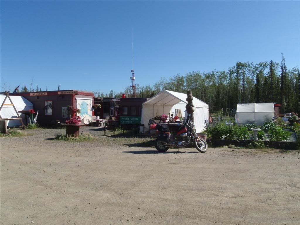
I did stop at this little placed called "The Hotspot" for a milkshake, and some postcards. I had about 120 miles to go to Coldfoot, the next gas station, and was currently running on the main tank's reserve. I refilled from my red gas cans, and pushed on.
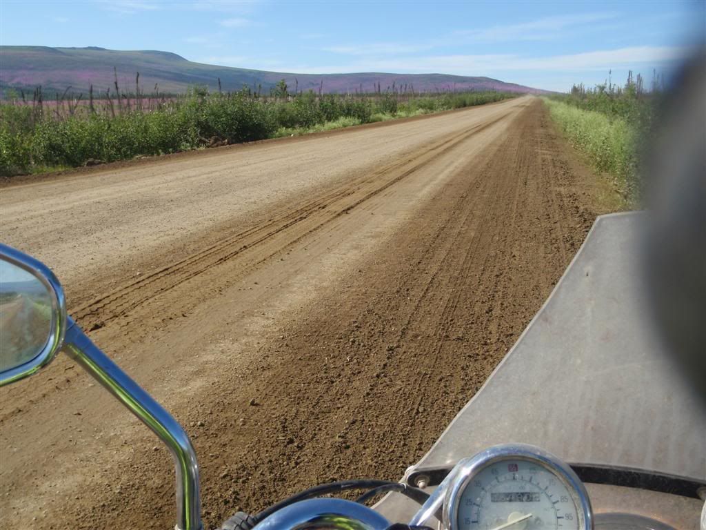
Once north of the Yukon river, the road conditions started to deteriorate a bit. Mostly a hard-packed clay, there were large sections that seemed to have baseball-sized rocks embedded deep in it, giving the effect of riding over a cobblestone road. It wasn't deep or tire-yanking, but damn was it rough.
There's not any shoulder on this road, and some of it is piled up quite high to get up ridge lines. Pay attention, or you (and your campervan/RV, by the looks of it) will end up in bad shape.
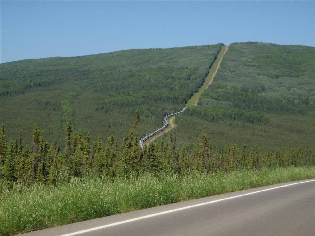
Farther north I went, the pipeline sometimes right next to the road for a while before darting off into the mountains on a more direct route. The trees were starting to thin out some, depending on the land's angle to the sun and how deep the permafrost was.

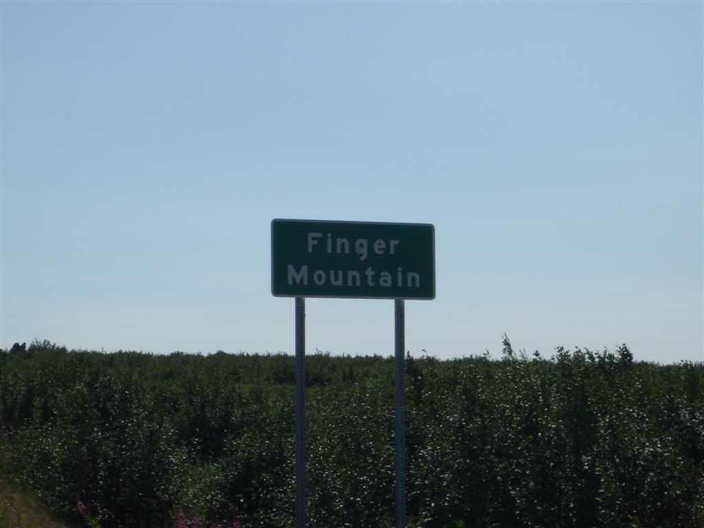
*giggles* You said finger . . .
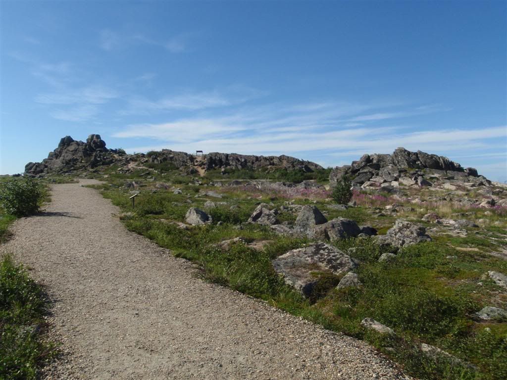
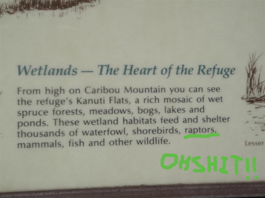
There was a small scenic rest area with some pit toilets and a short nature walk, and I took the opportunity to get off and stretch my legs. 15-year-old-me would have been so bored with 25-year-old me, as I was stopping and reading all of the little informational plaques along the trail.
OMGWTF?! I knew I had to be worried about bears up here, but THIS?!??!
And just as I was getting over the nightmares from watching Jurassic Park when I was like 8.
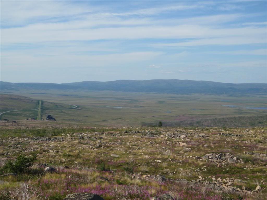
The land was getting more and more desolate the farther north I went.
About thirty miles north of Finger Mountain?
Goddamn stupid camera over-exposing. When I looked at this picture later, I made a mental note to stop by the sign again on the way back down and re-take it, but I must have spaced, because I never even remember driving back by the sign on my way south.
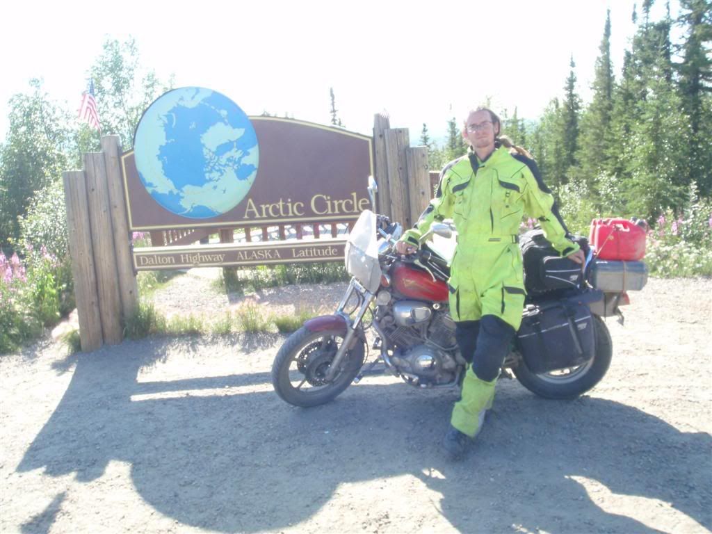
Officially in the Arctic Circle now, I kept on going north. Hrm, that's a funny shaped cloud off in the distance there.
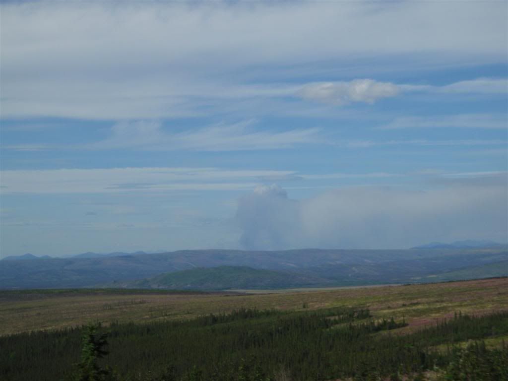
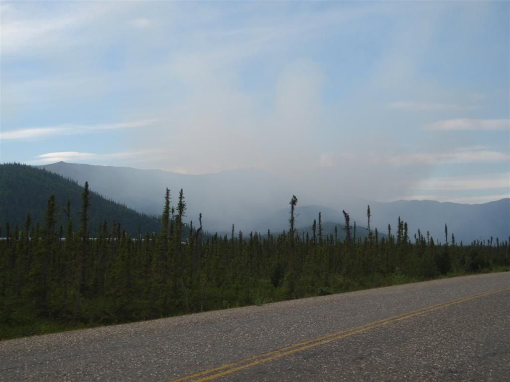
Crap, that's not a cloud, that's more forest fires.
In all of Alaska, as long as wildfires don't threaten human life or property, they are left to burn unimpeded. Many little informative plaques along the way pointed out how wildfires are a necessary and needed part of the area's ecosystem, and how many species depend on them for survival.
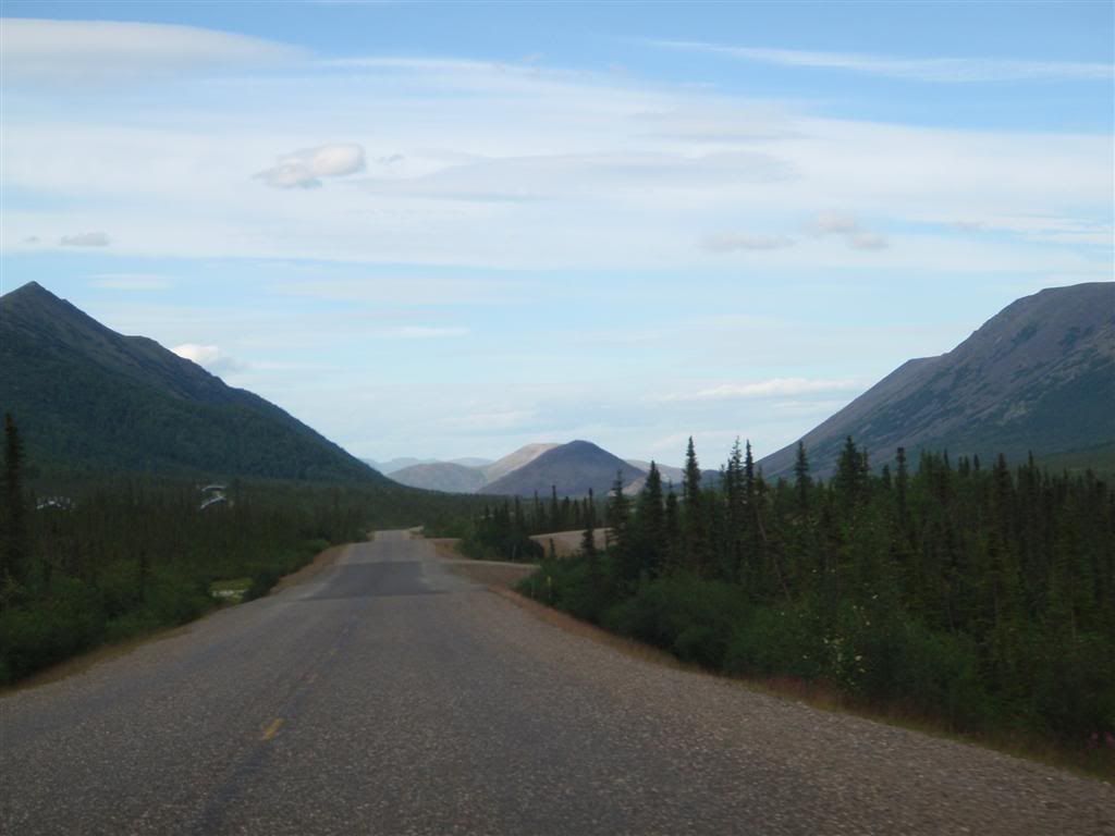
Soon later, I started getting into the foothills of the Brooks Range, the mountains that separate the North Slope of Alaska from the interior, both in a cartographer's mind, and in weather systems. The road followed river valleys, and started to get really scenic. It was getting late, and even though I was officially in the circle, the sun was low enough that it did hide behind the mountains.
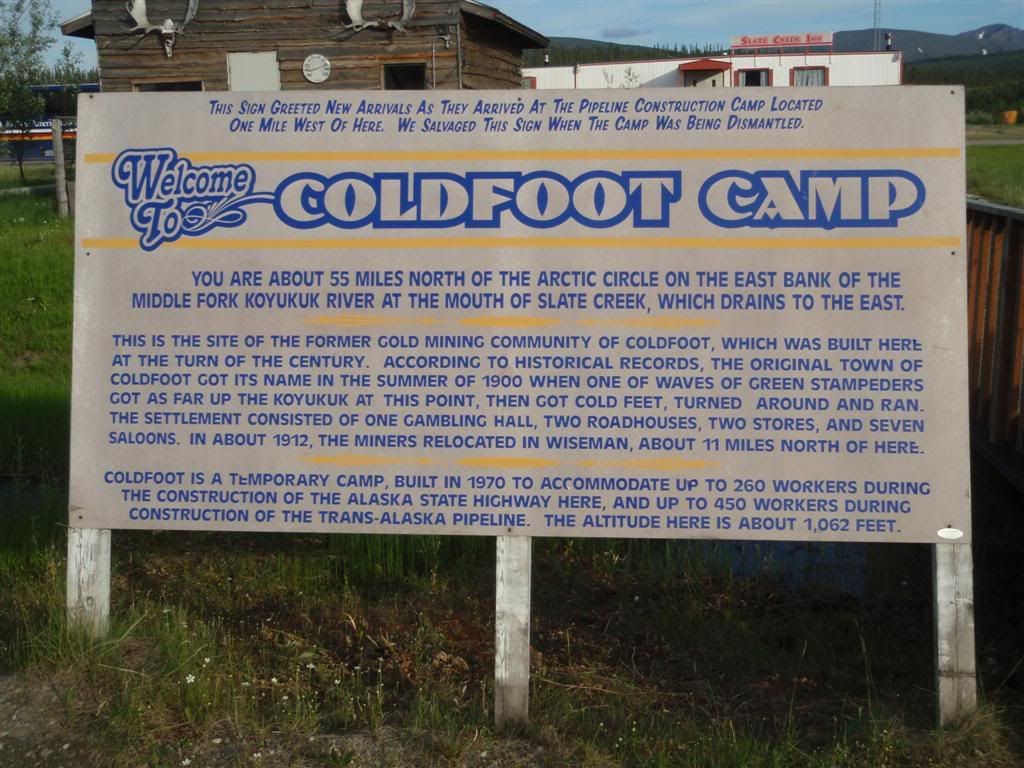
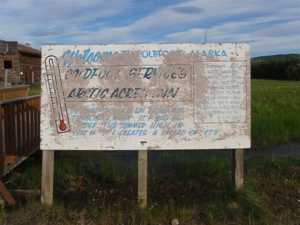
I reached the "town" of Coldfoot sometime around 8pm. At one point, it was a mining camp, and then a work camp when they were building the pipeline, but now it's just a motel, restraunt/gas station, and visitor info center, and a couple old buildings preserved for histories sake. That's it.
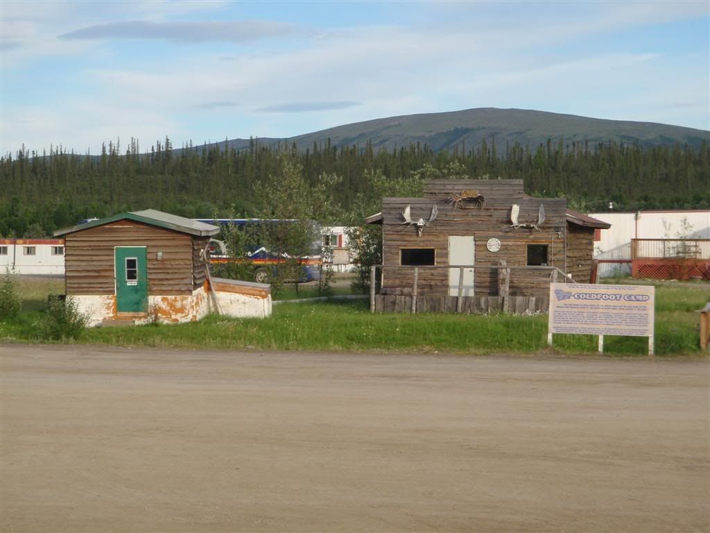
I would tell all the history of the place, but . . . well, just read the signs, it's easier.
After getting gas (at $4/gal), I went in to pay, and was very quickly distracted by the place's buffet. It was $18, almost twice my daily food budget, but just smelling it reminded me that I was VERY hungry. And was not looking forward to making do with another dinner of noodles from a camp stove. I signed, got out the card, and paid up. And then loaded up.
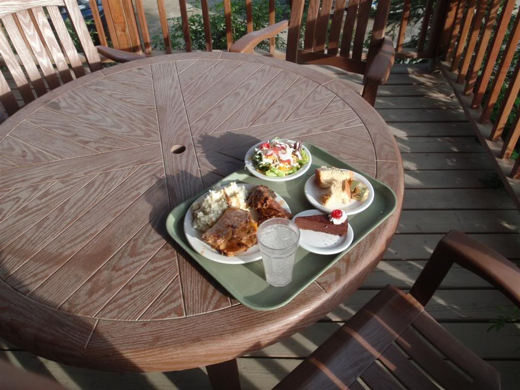
Two steaks, four pork chops, potatos, salad, bread, and cheesecake. And I actually went back for seconds on the salad. Hey, they said all I can eat, and I planned on making damn good use of my $18.
Now, there's a story here that happened just after I ate. It involved me, a huge dump, and a toilet overflowing in the worst way possible. Perhaps I'll save that for another post where I can shove it under it's own OH GOD TMI cut.
Anyway, after dealing with the, uh, fallout of said toilet, I stopped in at the Visitor Center. I was REALLY impressed with this place. It was far, far more then I would have expected for a speck of a town in the middle of nowhere, in the Arctic Circle.
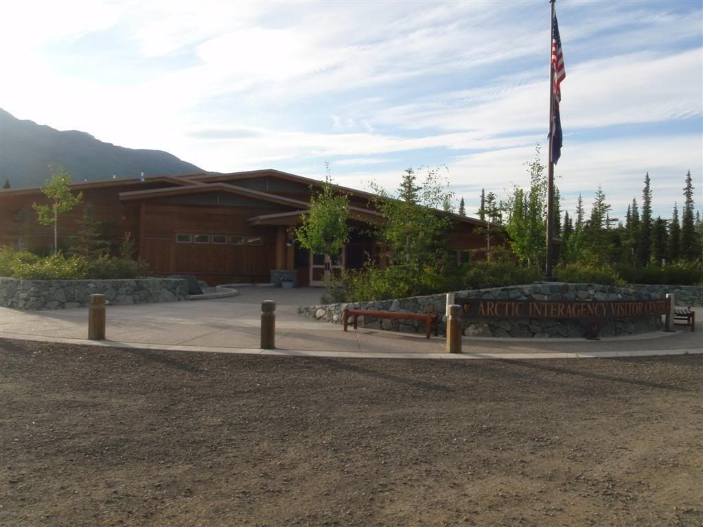
I mean, it was your standard National Park Service info place, but just really well done. Exhibits on all the various different plants and animals, how the survive and deal with the insane winters I think I was more suprised at just how nice it was, in such a remote place.
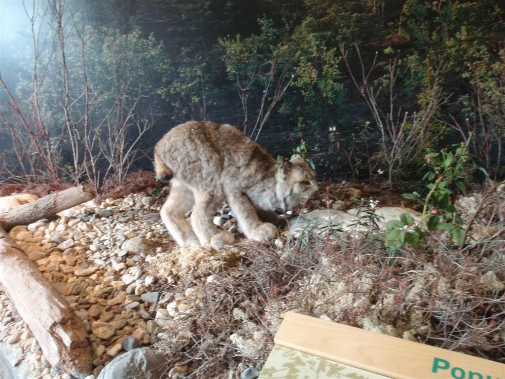
I swore that I'd taken more pictures while there, but I guess I hadn't. Just of this animal called a Lynx, which is essensially a kitty! Only with bigger feet.
I bought some postcards and more mosquito repellent, and made a small donation before getting on my way.
I was greated by a slew of warning signs on the way out.

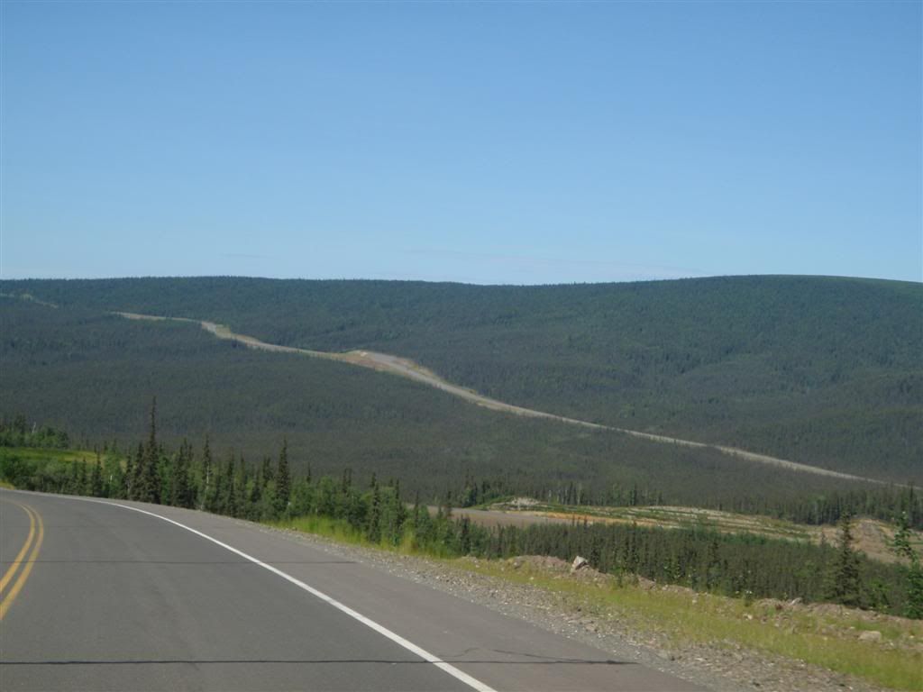
The road going north wasn't paved, but was still pretty good dirt. Very hard-packed without much loose stuff on the top, I could keep it around 45mph without worries. It just started getting more and more amazing.
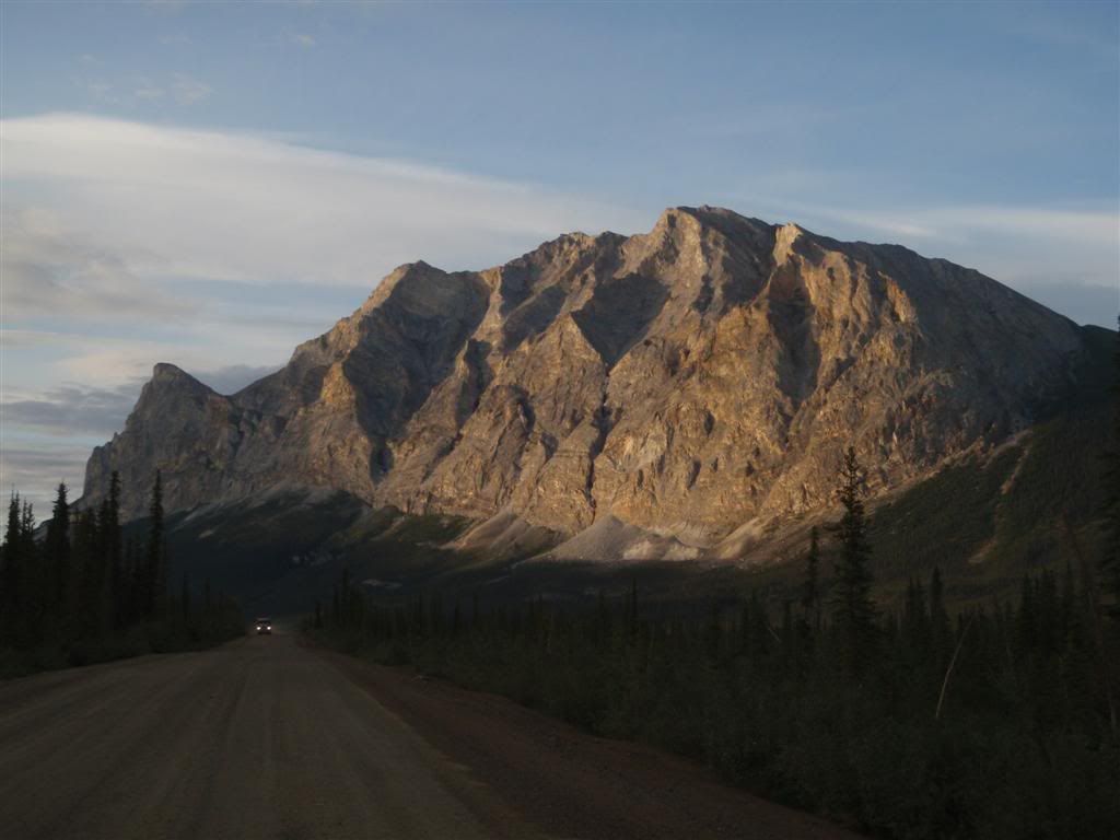
The mountians here are mostly solid marble, and the way in gleemed in the low sun was very impressive. I wish I'd captured it better, the size of it was just astonishing.
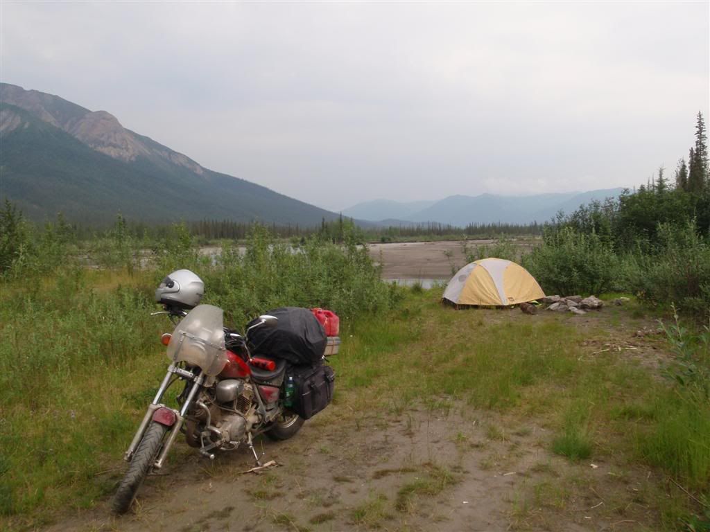
I camped on the banks of the river for the night, setting up in a remarkable abscence of mosquitos.
While there, I recorded this.
Shit! Library is closing. I'll do a part 2 tomorrow.
I headed down a gravel side road at some point, which was one of the rougher roads I'd been on. It was made up mostly of baseball-sized rocks that loved to toss my front tire in any and all directions, and gave me a good shaking around as well. I had to go for about a mile on this before I found a clearing to camp in.
(I actually took those photos the next day as I was heading out, but whatever)
Going north was good, smooth, paved road, providing occasional glances at something I would be seeing an awful lot of in the next few days.
About 70 miles north of Fairbanks, I saw the turnoff that I'd been looking for.
Covered in stickers from motorcycle clubs, mostly.
Immediately after the turn off, the road turns fairly rough. Rumor is that they purposefully keep the first fifteen miles or so of the road in lousy condition, to deter travelers who aren't really serious/able to deal with bad surfaces. It was mildly washboarded, and had some parts that had deep, loose gravel, but the worst part was the dust cloud kicked up by passing vehicles..
After about 15 miles, it did turn paved, and mostly stayed that way for the next hundred miles. There were some sections of gravel/dirt, but it was pretty smooth and in good shape, I could maintain 50mph over most of it without any worries.
Huge sections of the landscape going north were a brilliant purple, for miles and miles. Fireweed, so called because it grows back very quickly after wildfires, was everywhere, turning large patches of the mountains magenta.
The hills here were gently rolling, with lots of veiws out over miles and miles of untouched forest.
The road stayed mostly paved until I got to the Yukon river, which is traversed via a 6% grade wooden bridge. A hotel/gas station on the other side gives people a place to stop for fuel, but with the red reserve tanks strapped to the top of my camera, I was good for a while yet.
I did stop at this little placed called "The Hotspot" for a milkshake, and some postcards. I had about 120 miles to go to Coldfoot, the next gas station, and was currently running on the main tank's reserve. I refilled from my red gas cans, and pushed on.
Once north of the Yukon river, the road conditions started to deteriorate a bit. Mostly a hard-packed clay, there were large sections that seemed to have baseball-sized rocks embedded deep in it, giving the effect of riding over a cobblestone road. It wasn't deep or tire-yanking, but damn was it rough.
There's not any shoulder on this road, and some of it is piled up quite high to get up ridge lines. Pay attention, or you (and your campervan/RV, by the looks of it) will end up in bad shape.
Farther north I went, the pipeline sometimes right next to the road for a while before darting off into the mountains on a more direct route. The trees were starting to thin out some, depending on the land's angle to the sun and how deep the permafrost was.
*giggles* You said finger . . .
There was a small scenic rest area with some pit toilets and a short nature walk, and I took the opportunity to get off and stretch my legs. 15-year-old-me would have been so bored with 25-year-old me, as I was stopping and reading all of the little informational plaques along the trail.
OMGWTF?! I knew I had to be worried about bears up here, but THIS?!??!
And just as I was getting over the nightmares from watching Jurassic Park when I was like 8.
The land was getting more and more desolate the farther north I went.
About thirty miles north of Finger Mountain?
Goddamn stupid camera over-exposing. When I looked at this picture later, I made a mental note to stop by the sign again on the way back down and re-take it, but I must have spaced, because I never even remember driving back by the sign on my way south.
Officially in the Arctic Circle now, I kept on going north. Hrm, that's a funny shaped cloud off in the distance there.
Crap, that's not a cloud, that's more forest fires.
In all of Alaska, as long as wildfires don't threaten human life or property, they are left to burn unimpeded. Many little informative plaques along the way pointed out how wildfires are a necessary and needed part of the area's ecosystem, and how many species depend on them for survival.
Soon later, I started getting into the foothills of the Brooks Range, the mountains that separate the North Slope of Alaska from the interior, both in a cartographer's mind, and in weather systems. The road followed river valleys, and started to get really scenic. It was getting late, and even though I was officially in the circle, the sun was low enough that it did hide behind the mountains.
I reached the "town" of Coldfoot sometime around 8pm. At one point, it was a mining camp, and then a work camp when they were building the pipeline, but now it's just a motel, restraunt/gas station, and visitor info center, and a couple old buildings preserved for histories sake. That's it.
I would tell all the history of the place, but . . . well, just read the signs, it's easier.
After getting gas (at $4/gal), I went in to pay, and was very quickly distracted by the place's buffet. It was $18, almost twice my daily food budget, but just smelling it reminded me that I was VERY hungry. And was not looking forward to making do with another dinner of noodles from a camp stove. I signed, got out the card, and paid up. And then loaded up.
Two steaks, four pork chops, potatos, salad, bread, and cheesecake. And I actually went back for seconds on the salad. Hey, they said all I can eat, and I planned on making damn good use of my $18.
Now, there's a story here that happened just after I ate. It involved me, a huge dump, and a toilet overflowing in the worst way possible. Perhaps I'll save that for another post where I can shove it under it's own OH GOD TMI cut.
Anyway, after dealing with the, uh, fallout of said toilet, I stopped in at the Visitor Center. I was REALLY impressed with this place. It was far, far more then I would have expected for a speck of a town in the middle of nowhere, in the Arctic Circle.
I mean, it was your standard National Park Service info place, but just really well done. Exhibits on all the various different plants and animals, how the survive and deal with the insane winters I think I was more suprised at just how nice it was, in such a remote place.
I swore that I'd taken more pictures while there, but I guess I hadn't. Just of this animal called a Lynx, which is essensially a kitty! Only with bigger feet.
I bought some postcards and more mosquito repellent, and made a small donation before getting on my way.
I was greated by a slew of warning signs on the way out.
The road going north wasn't paved, but was still pretty good dirt. Very hard-packed without much loose stuff on the top, I could keep it around 45mph without worries. It just started getting more and more amazing.
The mountians here are mostly solid marble, and the way in gleemed in the low sun was very impressive. I wish I'd captured it better, the size of it was just astonishing.
I camped on the banks of the river for the night, setting up in a remarkable abscence of mosquitos.
While there, I recorded this.
Shit! Library is closing. I'll do a part 2 tomorrow.
Wonderful post, and photos too!! Can't wait to see pics of Prudhoe bay and Deadhorse!!!
ReplyDelete